|
search place name
|
||
Neftenbach (Aargau, Switzerland)Neftenbach is a town in the Aargau region of Switzerland. An overview map of the region around Neftenbach is displayed below.
regional and 3d topo map of Neftenbach, Switzerland ::

Neftenbach airports ::
The nearest airport is ZRH - Zurich, located 11.7 km south west of Neftenbach.
Other airports nearby include ZQL - Donaueschingen Villingen (50.1 km north), FDH - Friedrichshafen (65.4 km east), ACH - St Gallen Altenrhein (67.6 km east), MLH - Bale Mulhouse (85.8 km west), Nearby towns ::
Henggart (2.2km north east) //
Veltheim (2.5km east) //
Hettlingen (3.1km north east) //
Pfungen (3.1km south west) //
Buch (3.1km north west) //
Ober-Buch (3.1km north west) //
Unter-Buch (3.1km north west) //
Töss (4.5km south east) //
Seuzach (5.0km east) //
Breite (7.4km south) //
Brütten (7.4km south) //
Grossandelfingen (7.5km north) //
Alten (7.5km north) //
Oberembrach (6.7km south west) //
Embrach (6.2km south west) //
Flaach (7.5km north west) //
Ellikon am Rhein (8.3km north west) //
[all distances 'as the bird flies' and approximate] 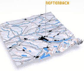 Places with similar names to Neftenbach, Switzerland :: Disclaimer :: Information on this page comes without warranty of any kind |
||
|
Where is Neftenbach? Elevation and coordinates ::
Latitude (lat): 47°32'0"N Longitude (lon): 8°40'0"E
Elevation (approx.): 418m (map arrows pan, magnifying glasses zoom) |
||
|
Visiting Neftenbach? Hotel/Accommodation ::
Book a hotel in Neftenbach Travel Guide ::
Buy a travel guide for Switzerland rental cars ::
car rental offers GPS waypoint ::
download a GPX waypoint (PoI) of Neftenbach for your GPS receiver
|
||