|
search place name
|
||
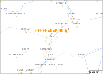
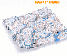
Pfaffensprung (Aargau, Switzerland)Pfaffensprung is a town in the Aargau region of Switzerland. An overview map of the region around Pfaffensprung is displayed below.
regional and 3d topo map of Pfaffensprung, Switzerland ::
Pfaffensprung airports ::
The nearest airport is LUG - Lugano, located 82.7 km south of Pfaffensprung.
Other airports nearby include ZRH - Zurich (83.3 km north), BRN - Bern Belp (87.0 km west), SMV - Samedan (100.4 km east), ACH - St Gallen Altenrhein (112.3 km north east), Nearby towns ::
 Places with similar names to Pfaffensprung, Switzerland :: Disclaimer :: Information on this page comes without warranty of any kind |
||
|
Where is Pfaffensprung? Elevation and coordinates ::
Latitude (lat): 46°43'0"N Longitude (lon): 8°36'0"E
Elevation (approx.): 1328m (map arrows pan, magnifying glasses zoom) |
||
|
Visiting Pfaffensprung? Hotel/Accommodation ::
Book a hotel in Pfaffensprung Travel Guide ::
Buy a travel guide for Switzerland rental cars ::
car rental offers GPS waypoint ::
download a GPX waypoint (PoI) of Pfaffensprung for your GPS receiver
|
||