|
search place name
|
||
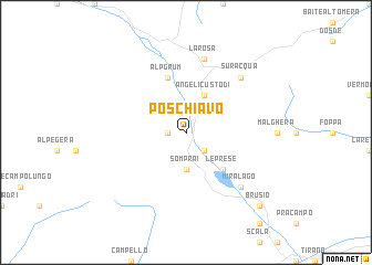
Poschiavo (Aargau, Switzerland)Poschiavo is a town in the Aargau region of Switzerland. An overview map of the region around Poschiavo is displayed below.
regional and 3d topo map of Poschiavo, Switzerland ::
Poschiavo airports ::
The nearest airport is SMV - Samedan, located 25.7 km north west of Poschiavo.
Other airports nearby include BGY - Bergamo Orio Al Serio (78.0 km south), LUG - Lugano (95.3 km west), BZO - Bolzano (99.2 km east), VBS - Montichiari (102.9 km south), Nearby towns ::
San Carlo (1.3km west) //
Prada (2.3km south east) //
Alpe Braita (3.7km south) //
Somprai (3.7km south) //
Angeli Custodi (3.9km north) //
Le Prese (4.5km south east) //
Alp Grüm (5.7km north) //
La Rösa (7.5km north) //
Suracqua (6.8km north east) //
Miralago (6.8km south east) //
Brusio (9.0km south east) //
[all distances 'as the bird flies' and approximate]  Places with similar names to Poschiavo, Switzerland ::
// Piskovë (AL)
// Puzikovo (UA)
// Pisgah View (US)
// Passo Covo (IN)
// Passe Café (HT)
// Pasʼkovo (UA)
// Pasʼkovo (UA)
// Pesikovo (RU)
// Paskov (CZ)
// Peschiva (RU)
Disclaimer :: Information on this page comes without warranty of any kind |
||
|
Where is Poschiavo? Elevation and coordinates ::
Latitude (lat): 46°20'0"N Longitude (lon): 10°3'0"E
Elevation (approx.): 1206m (map arrows pan, magnifying glasses zoom) |
||
|
Visiting Poschiavo? Hotel/Accommodation ::
Book a hotel in Poschiavo Travel Guide ::
Buy a travel guide for Switzerland rental cars ::
car rental offers GPS waypoint ::
download a GPX waypoint (PoI) of Poschiavo for your GPS receiver
|
||