|
search place name
|
||
Radelfingen (Aargau, Switzerland)Radelfingen is a town in the Aargau region of Switzerland. An overview map of the region around Radelfingen is displayed below.
regional and 3d topo map of Radelfingen, Switzerland ::

Radelfingen airports ::
The nearest airport is BRN - Bern Belp, located 20.9 km south east of Radelfingen.
Other airports nearby include MLH - Bale Mulhouse (66.7 km north), SIR - Sion (88.7 km south), ZRH - Zurich (109.1 km north east), QNJ - Annemasse (119.4 km south west), Nearby towns ::
Kallnach (2.5km west) //
Frieswil (3.7km south) //
Aarberg (3.9km north) //
Seedorf (3.1km north east) //
Kappelen (3.9km north) //
Käppeli (4.5km south west) //
Lyss (6.1km north east) //
Fräschels (5.3km south west) //
Wileroltigen (6.1km south west) //
Mühleberg (7.5km south) //
Suberg (6.3km north east) //
Säriswil (6.3km south east) //
Mörigen (8.3km north west) //
Illiswil (7.5km south east) //
Täuffelen (7.5km north west) //
Ferenbalm (8.3km south west) //
Jaggisbachau (8.3km south east) //
Kerzers (7.5km south west) //
Frauenkappelen (9.0km south east) //
Jerisberghof (9.0km south west) //
[all distances 'as the bird flies' and approximate] 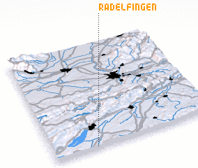 Places with similar names to Radelfingen, Switzerland :: Disclaimer :: Information on this page comes without warranty of any kind |
||
|
Where is Radelfingen? Elevation and coordinates ::
Latitude (lat): 47°1'0"N Longitude (lon): 7°16'0"E
Elevation (approx.): 533m (map arrows pan, magnifying glasses zoom) |
||
|
Visiting Radelfingen? Hotel/Accommodation ::
Book a hotel in Radelfingen Travel Guide ::
Buy a travel guide for Switzerland rental cars ::
car rental offers GPS waypoint ::
download a GPX waypoint (PoI) of Radelfingen for your GPS receiver
|
||