|
search place name
|
||
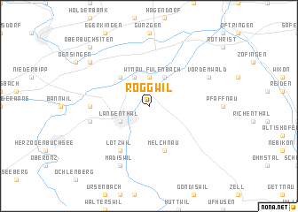
Roggwil (Aargau, Switzerland)Roggwil is a town in the Aargau region of Switzerland. An overview map of the region around Roggwil is displayed below.
regional and 3d topo map of Roggwil, Switzerland ::
Roggwil airports ::
The nearest airport is BRN - Bern Belp, located 43.0 km south west of Roggwil.
Other airports nearby include MLH - Bale Mulhouse (45.1 km north west), ZRH - Zurich (61.0 km north east), ZQL - Donaueschingen Villingen (97.9 km north east), CMR - Colmar Houssen (103.3 km north), Nearby towns ::
Murgenthal (3.7km north) //
Langenthal (3.1km south west) //
Fulenbach (3.9km north) //
Wynau (3.9km north) //
Wolfwil (4.5km north west) //
Melchnau (5.7km south) //
Lotzwil (6.1km south west) //
Aarwangen (5.0km west) //
Bützberg (5.4km west) //
Madiswil (7.8km south) //
Vordemwald (6.2km north east) //
Niederbuchsiten (7.5km north west) //
Oberbuchsiten (9.0km north west) //
[all distances 'as the bird flies' and approximate] 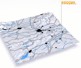 Places with similar names to Roggwil, Switzerland ::
Disclaimer :: Information on this page comes without warranty of any kind |
||
|
Where is Roggwil? Elevation and coordinates ::
Latitude (lat): 47°14'0"N Longitude (lon): 7°49'0"E
Elevation (approx.): 494m (map arrows pan, magnifying glasses zoom) |
||
|
Visiting Roggwil? Hotel/Accommodation ::
Book a hotel in Roggwil Travel Guide ::
Buy a travel guide for Switzerland rental cars ::
car rental offers GPS waypoint ::
download a GPX waypoint (PoI) of Roggwil for your GPS receiver
|
||