|
search place name
|
||
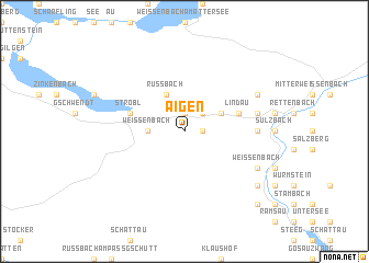
Aigen (Salzburg, Austria)Aigen is a town in the Salzburg region of Austria. An overview map of the region around Aigen is displayed below.
regional and 3d topo map of Aigen, Austria ::
Aigen airports ::
The nearest airport is SZG - Salzburg, located 41.0 km west of Aigen.
Other airports nearby include LNZ - Linz (Horsching) (76.8 km north east), KLU - Klagenfurt (Worthersee Intl) (132.4 km south east), MUC - Munich Munchen (149.2 km north west), GRZ - Graz (164.2 km south east), Nearby towns ::
Radau (1.9km north) //
Ramsau (1.2km east) //
Aschau (2.2km north east) //
Weissenbach (2.5km west) //
Russbach (3.9km north) //
Haiden (3.1km north east) //
Ahorn (4.2km north east) //
Lindau (4.2km north east) //
Strobl (4.2km north west) //
Katereck (5.0km east) //
Kaltenbach (5.0km east) //
Steinbruch (5.3km east) //
Pfandl (5.3km east) //
Kreutern (5.3km east) //
Hahnlfeld (6.2km north east) //
Weißenbach (6.2km south east) //
Unterjoch (7.5km south east) //
Wildpfad (7.5km south east) //
Steinach (8.9km south east) //
[all distances 'as the bird flies' and approximate]  Places with similar names to Aigen, Austria ::
Disclaimer :: Information on this page comes without warranty of any kind |
||
|
Where is Aigen? Elevation and coordinates ::
Latitude (lat): 47°42'0"N Longitude (lon): 13°32'0"E
Elevation (approx.): 880m (map arrows pan, magnifying glasses zoom) |
||
|
Visiting Aigen? Hotel/Accommodation ::
Book a hotel in Aigen Travel Guide ::
Buy a travel guide for Austria rental cars ::
car rental offers GPS waypoint ::
download a GPX waypoint (PoI) of Aigen for your GPS receiver
|
||