|
search place name
|
||
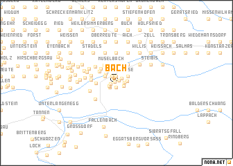
Bach (Vorarlberg, Austria)Bach is a town in the Vorarlberg region of Austria. An overview map of the region around Bach is displayed below.
regional and 3d topo map of Bach, Austria ::
Bach airports ::
The nearest airport is ACH - St Gallen Altenrhein, located 30.7 km west of Bach.
Other airports nearby include FDH - Friedrichshafen (38.8 km north west), ZRH - Zurich (106.9 km west), INN - Innsbruck (107.5 km east), SMV - Samedan (108.3 km south), Nearby towns ::
Stapfen (0.3km north west) //
Vögen (0.5km north east) //
Riefensberg (0.7km south) //
Unterdorf (0.7km west) //
Auen (0.9km north east) //
Aach (1.1km north) //
Unterlitten (1.1km north west) //
Schwarzen (0.9km south west) //
Hochlitten (0.9km east) //
Längern (1.0km south west) //
Elmauen (1.0km south east) //
Hütten (1.2km east) //
Hänse (1.7km north east) //
Hagspiel (1.7km north east) //
Springen (1.7km north west) //
Hermannshansen (1.9km north west) //
Unterhalden (2.2km north west) //
Gullenbach (2.6km north) //
Müselbach (2.9km north) //
Schlucht (3.0km north) //
Zellers (3.0km north) //
Hermannsberg (2.6km north west) //
Hasen (2.3km west) //
Gschwendele (2.9km north west) //
Hütten (3.2km north east) //
Krebs (3.2km north east) //
Glafberg (3.2km north west) //
Brunnenau (2.8km west) //
Simlisgschwend (3.0km north west) //
[all distances 'as the bird flies' and approximate]  Places with similar names to Bach, Austria ::
Disclaimer :: Information on this page comes without warranty of any kind |
||
|
Where is Bach? Elevation and coordinates ::
Latitude (lat): 47°30'24"N Longitude (lon): 9°58'0"E
Elevation (approx.): 800m (map arrows pan, magnifying glasses zoom) |
||
|
Visiting Bach? Hotel/Accommodation ::
Book a hotel in Bach Travel Guide ::
Buy a travel guide for Austria rental cars ::
car rental offers GPS waypoint ::
download a GPX waypoint (PoI) of Bach for your GPS receiver
|
||