|
search place name
|
||
Baumgarten (Oberösterreich, Austria)Baumgarten is a town in the Oberösterreich region of Austria. An overview map of the region around Baumgarten is displayed below.
regional and 3d topo map of Baumgarten, Austria ::

Baumgarten airports ::
The nearest airport is LNZ - Linz (Horsching), located 34.4 km west of Baumgarten.
Other airports nearby include SZG - Salzburg (131.5 km west), VIE - Vienna Schwechat (143.3 km east), GRZ - Graz (148.6 km south east), KLU - Klagenfurt (Worthersee Intl) (176.6 km south), Nearby towns ::
Holzleithen (1.9km south) //
Feld (1.9km south) //
Neuhof (1.2km east) //
Laab (1.2km west) //
Pratztrum (2.2km north west) //
Auhof (2.2km north east) //
Pergkirchen (2.2km north east) //
Tabor (2.2km south west) //
Holzpoint (2.5km east) //
Dürnwagram (2.5km west) //
Strass (2.5km west) //
Starzing (3.7km south) //
Ruprechtshofen (3.7km south) //
Tobra (3.1km north east) //
Wimm (3.1km north west) //
Loa (3.1km south east) //
Staffling (3.1km south west) //
Perg (3.9km north) //
Dörfl (4.5km north east) //
Zeitling (4.5km north west) //
Weisching (4.5km south east) //
Arbing (3.7km east) //
Naarn im Machland (3.7km west) //
Winkl (4.1km north west) //
Aist (4.1km north west) //
Egg (5.7km south) //
Lehenbrunn (5.7km north) //
Berg (6.1km south west) //
Groissing (5.2km north east) //
[all distances 'as the bird flies' and approximate] 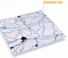 Places with similar names to Baumgarten, Austria ::
// Baumgarten (AT)
// Baumgarten (AT)
// Baumgarten (AT)
// Baumgarten (AT)
// Baumgarten (AT)
// Baumgarten (AT)
// Baumgarten (AT)
// Baumgarten (DE)
// Baumgarten (DE)
// Baumgarten (DE)
Disclaimer :: Information on this page comes without warranty of any kind |
||
|
Where is Baumgarten? Elevation and coordinates ::
Latitude (lat): 48°13'0"N Longitude (lon): 14°39'0"E
Elevation (approx.): 238m (map arrows pan, magnifying glasses zoom) |
||
|
Visiting Baumgarten? Hotel/Accommodation ::
Book a hotel in Baumgarten Travel Guide ::
Buy a travel guide for Austria rental cars ::
car rental offers GPS waypoint ::
download a GPX waypoint (PoI) of Baumgarten for your GPS receiver
|
||