|
search place name
|
||
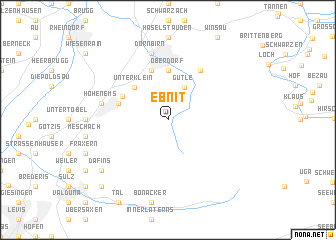
Ebnit (Vorarlberg, Austria)Ebnit is a town in the Vorarlberg region of Austria. An overview map of the region around Ebnit is displayed below.
regional and 3d topo map of Ebnit, Austria ::
Ebnit airports ::
The nearest airport is ACH - St Gallen Altenrhein, located 20.7 km north west of Ebnit.
Other airports nearby include FDH - Friedrichshafen (40.0 km north west), SMV - Samedan (91.3 km south), ZRH - Zurich (91.5 km west), ZQL - Donaueschingen Villingen (115.4 km north west), Nearby towns ::
Gütle (3.9km north) //
Unterklein (4.5km north west) //
Oberklein (4.5km north west) //
Oberdorf (5.5km north) //
Reute (4.3km north west) //
Hatlerdorf (5.7km north) //
Mühlebach (5.7km north) //
Reute-Tugstein (4.2km north west) //
Kehlegg (6.1km north east) //
Dornbirn (7.5km north) //
Hohenems (5.4km west) //
Dafins (7.5km south west) //
Buchebrunnen (9.0km south west) //
[all distances 'as the bird flies' and approximate]  Places with similar names to Ebnit, Austria ::
Disclaimer :: Information on this page comes without warranty of any kind |
||
|
Where is Ebnit? Elevation and coordinates ::
Latitude (lat): 47°21'0"N Longitude (lon): 9°45'0"E
Elevation (approx.): 1013m (map arrows pan, magnifying glasses zoom) |
||
|
Visiting Ebnit? Hotel/Accommodation ::
Book a hotel in Ebnit Travel Guide ::
Buy a travel guide for Austria rental cars ::
car rental offers GPS waypoint ::
download a GPX waypoint (PoI) of Ebnit for your GPS receiver
|
||