|
search place name
|
||
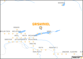
Gaiswinkel (Steiermark, Austria)Gaiswinkel is a town in the Steiermark region of Austria. An overview map of the region around Gaiswinkel is displayed below.
regional and 3d topo map of Gaiswinkel, Austria ::
Gaiswinkel airports ::
The nearest airport is SZG - Salzburg, located 66.6 km west of Gaiswinkel.
Other airports nearby include LNZ - Linz (Horsching) (69.1 km north), KLU - Klagenfurt (Worthersee Intl) (117.6 km south), GRZ - Graz (139.7 km south east), LJU - Ljubliana Ljubljana (164.8 km south), Nearby towns ::
Kreuz (1.9km south) //
Rösslern (2.2km south west) //
Hopfgarten (2.2km south west) //
Gössl (3.1km south east) //
Zlaim (4.5km south west) //
Archkogel (4.5km south west) //
Grundlsee (5.3km south west) //
Bräuhof (5.3km south west) //
Au (5.3km south west) //
Mosern (5.3km south west) //
Gschlößl (6.1km south west) //
Untertressen (5.3km west) //
Gallhof (6.7km south west) //
Anger (6.7km south west) //
Hintenkogel (6.2km south west) //
Vorwerk (6.2km south west) //
Reith (6.2km south west) //
Radling (7.8km south) //
Sießreith (7.5km south west) //
[all distances 'as the bird flies' and approximate]  Places with similar names to Gaiswinkel, Austria ::
// Kasewinkel (DE)
Disclaimer :: Information on this page comes without warranty of any kind |
||
|
Where is Gaiswinkel? Elevation and coordinates ::
Latitude (lat): 47°39'0"N Longitude (lon): 13°52'0"E
Elevation (approx.): 1339m (map arrows pan, magnifying glasses zoom) |
||
|
Visiting Gaiswinkel? Hotel/Accommodation ::
Book a hotel in Gaiswinkel Travel Guide ::
Buy a travel guide for Austria rental cars ::
car rental offers GPS waypoint ::
download a GPX waypoint (PoI) of Gaiswinkel for your GPS receiver
|
||