|
search place name
|
||
Grosshattenberg (Kärnten, Austria)Grosshattenberg is a town in the Kärnten region of Austria. An overview map of the region around Grosshattenberg is displayed below.
regional and 3d topo map of Grosshattenberg, Austria ::

Grosshattenberg airports ::
The nearest airport is KLU - Klagenfurt (Worthersee Intl), located 67.8 km south east of Grosshattenberg.
Other airports nearby include LJU - Ljubliana Ljubljana (103.3 km south east), SZG - Salzburg (107.1 km north), TRS - Ronchi De Legionari Ronchi Dei Legionari (119.3 km south), AVB - Aviano Ab (Pagliano E Gori) (120.4 km south west), Nearby towns ::
Puchreit (0.0km north) //
Gmünd (0.9km north) //
Perau (1.2km south) //
Oberbuch (1.3km east) //
Unterbuch (1.3km east) //
Unterkreuschlach (1.9km north) //
Oberkreuschlach (1.9km north) //
Kleinhattenberg (2.2km north west) //
Trebesing (2.3km south west) //
Saps (3.9km north) //
Hilpersdorferau (3.9km north) //
Zlatting (3.1km south west) //
Eisentratten (3.6km north east) //
Dornbach (4.2km north west) //
Neuschitz (3.7km south west) //
Strasser (4.5km south west) //
Heitzelsberg (4.5km north east) //
Hilpersdorf (5.5km north) //
Altersberg (5.4km south west) //
Treffling (6.4km south) //
Pirk (5.3km south west) //
Gries (6.1km north west) //
Untermalta (6.1km north west) //
Vordernöring (4.7km east) //
Obermalta (6.7km north) //
Laggen (5.2km north east) //
Liedweg (7.4km south) //
Schlatzing (6.7km north west) //
Maltaberg (7.5km north) //
[all distances 'as the bird flies' and approximate] 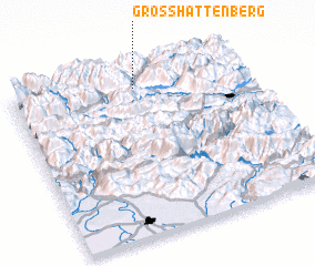 Places with similar names to Grosshattenberg, Austria ::
// Christinaberg (AT)
// Christenberg (AT)
// Großsteinberg (DE)
// Kerstenberg (DE)
// Kristineberg (SE)
// Kristineberg (SE)
// Kristineberg (SE)
// Kristineberg (SE)
// Kristineberg (SE)
Disclaimer :: Information on this page comes without warranty of any kind |
||
|
Where is Grosshattenberg? Elevation and coordinates ::
Latitude (lat): 46°54'0"N Longitude (lon): 13°32'0"E
Elevation (approx.): 786m (map arrows pan, magnifying glasses zoom) |
||
|
Visiting Grosshattenberg? Hotel/Accommodation ::
Book a hotel in Grosshattenberg Travel Guide ::
Buy a travel guide for Austria rental cars ::
car rental offers GPS waypoint ::
download a GPX waypoint (PoI) of Grosshattenberg for your GPS receiver
|
||