|
search place name
|
||
Hartmannsdorf (Oberösterreich, Austria)Hartmannsdorf is a town in the Oberösterreich region of Austria. An overview map of the region around Hartmannsdorf is displayed below.
regional and 3d topo map of Hartmannsdorf, Austria ::

Hartmannsdorf airports ::
The nearest airport is LNZ - Linz (Horsching), located 38.5 km south of Hartmannsdorf.
Other airports nearby include SZG - Salzburg (115.9 km south west), PRG - Prague Ruzyne (171.3 km north), KLV - Karlovy Vary (199.8 km north west), PED - Pardubice (202.4 km north east), Nearby towns ::
Nösslbach (1.2km west) //
Haslach an der Mühl (2.2km north west) //
Lichtenau im Mühlkreis (2.2km north west) //
Neudorf (2.2km south east) //
Kasten (2.2km south east) //
Oberriedl (2.5km east) //
Oedt (3.7km north) //
Marbach (3.7km south) //
Auberg (3.7km south) //
Hehenberg (3.7km south) //
Haid (3.1km north east) //
Unterriedl (3.1km south east) //
Frindorf (3.1km south west) //
Hörleinsödt (3.9km north) //
Damreith (3.9km north) //
Wippling (3.9km south) //
Rožnov (4.4km north east) //
Gattergassling (4.4km north west) //
Annatsberg (4.4km south east) //
Sankt Stefan am Walde (3.7km east) //
Muckenschlag (5.6km north) //
Innenschlag (4.1km north east) //
Gintersberg (4.1km north west) //
Sexling (4.1km north west) //
Neundling (4.1km south west) //
Jasánky (5.7km north) //
Rychnŭvek (5.7km north) //
Sankt Oswald bei Haslach (5.7km north) //
Schörsching (6.1km south west) //
[all distances 'as the bird flies' and approximate] 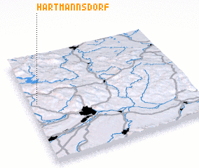 Places with similar names to Hartmannsdorf, Austria ::
// Hartmannsdorf (AT)
// Hartmannsdorf (AT)
// Hartmannsdorf (DE)
// Hartmannsdorf (DE)
// Hartmannsdorf (DE)
// Hartmannsdorf (DE)
// Hartmannsdorf (DE)
// Hartmannsdorf (DE)
// Hartmannsdorf (DE)
// Hartmannsdorf (DE)
Disclaimer :: Information on this page comes without warranty of any kind |
||
|
Where is Hartmannsdorf? Elevation and coordinates ::
Latitude (lat): 48°34'0"N Longitude (lon): 14°3'0"E
Elevation (approx.): 585m (map arrows pan, magnifying glasses zoom) |
||
|
Visiting Hartmannsdorf? Hotel/Accommodation ::
Book a hotel in Hartmannsdorf Travel Guide ::
Buy a travel guide for Austria rental cars ::
car rental offers GPS waypoint ::
download a GPX waypoint (PoI) of Hartmannsdorf for your GPS receiver
|
||