|
search place name
|
||
Innerberg (Vorarlberg, Austria)Innerberg is a town in the Vorarlberg region of Austria. An overview map of the region around Innerberg is displayed below.
regional and 3d topo map of Innerberg, Austria ::

Innerberg airports ::
The nearest airport is ACH - St Gallen Altenrhein, located 34.2 km north west of Innerberg.
Other airports nearby include FDH - Friedrichshafen (54.5 km north), SMV - Samedan (76.3 km south), ZRH - Zurich (97.2 km west), INN - Innsbruck (118.3 km east), Nearby towns ::
Ludesch (1.9km south) //
Thüringen (2.2km south west) //
Bassing (2.5km west) //
Blons (2.5km east) //
Unterfeld (4.0km south) //
Ludescherberg (3.1km south east) //
Raggal (3.8km east) //
Schnifis (3.8km west) //
Bludesch (4.2km south west) //
Nüziders (5.7km south) //
Innerlaterns (5.3km north west) //
Muttersberg (5.3km south east) //
Düns (5.0km west) //
Matin (7.5km south) //
Bürs (7.6km south) //
Bonacker (6.7km north west) //
Gais (5.8km south west) //
Bludenz (7.9km south) //
Rungelin (8.3km south east) //
Bings (9.0km south east) //
[all distances 'as the bird flies' and approximate] 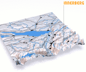
Disclaimer :: Information on this page comes without warranty of any kind |
||
|
Where is Innerberg? Elevation and coordinates ::
Latitude (lat): 47°13'0"N Longitude (lon): 9°46'59"E
Elevation (approx.): 937m (map arrows pan, magnifying glasses zoom) |
||
|
Visiting Innerberg? Hotel/Accommodation ::
Book a hotel in Innerberg Travel Guide ::
Buy a travel guide for Austria rental cars ::
car rental offers GPS waypoint ::
download a GPX waypoint (PoI) of Innerberg for your GPS receiver
|
||