|
search place name
|
||
Kamphütten (Niederösterreich, Austria)Kamphütten is a town in the Niederösterreich region of Austria. An overview map of the region around Kamphütten is displayed below.
regional and 3d topo map of Kamphütten, Austria ::

nearby GPS traces from timatio ::
Kamphütten airports ::
The nearest airport is LNZ - Linz (Horsching), located 97.8 km south west of Kamphütten.
Other airports nearby include VIE - Vienna Schwechat (101.4 km south east), BRQ - Turany (114.0 km north east), BTS - Bratislava M R Stefanik (141.9 km east), PED - Pardubice (160.9 km north), Nearby towns ::
Kienberg (1.9km north) //
Wetzlas (1.9km north) //
Mottingeramt (2.2km south west) //
Reichhalms (2.2km north west) //
Schmerbach am Kamp (2.2km north east) //
Krumau am Kamp (2.5km east) //
Waldreichs (3.1km north west) //
Grossmotten (3.9km south) //
Franzen (3.9km north) //
Nondorf (3.9km north) //
Neubau (4.4km south east) //
Eisengraberamt (4.4km south east) //
Grottendorf (5.6km south) //
Preinreichs (4.1km south east) //
Moritzreith (5.7km south) //
Tiefenbach (4.1km north east) //
Neupölla (6.1km north east) //
Kleinraabs (6.1km north east) //
Sperkenthal (6.1km south west) //
Kleinenzersdorf (5.2km north east) //
Heinreichs (5.2km north west) //
Pallweis (7.4km south) //
Peigarten (4.9km west) //
Reisling (7.5km south) //
Rastbach (7.5km south) //
Zierings (5.2km west) //
Ottenstein (5.2km west) //
Marbach im Felde (6.7km south west) //
Obergrünbach (7.8km south) //
[all distances 'as the bird flies' and approximate] 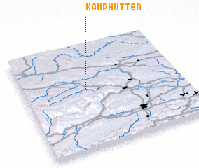 Places with similar names to Kamphütten, Austria :: Disclaimer :: Information on this page comes without warranty of any kind |
||
|
Where is Kamphütten? Elevation and coordinates ::
Latitude (lat): 48°35'0"N Longitude (lon): 15°24'0"E
Elevation (approx.): 475m (map arrows pan, magnifying glasses zoom) |
||
|
Visiting Kamphütten? Hotel/Accommodation ::
Book a hotel in Kamphütten Travel Guide ::
Buy a travel guide for Austria rental cars ::
car rental offers GPS waypoint ::
download a GPX waypoint (PoI) of Kamphütten for your GPS receiver
|
||