|
search place name
|
||
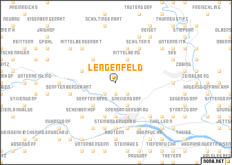
Lengenfeld (Niederösterreich, Austria)Lengenfeld is a town in the Niederösterreich region of Austria. An overview map of the region around Lengenfeld is displayed below.
regional and 3d topo map of Lengenfeld, Austria ::
nearby GPS traces from timatio ::
Lengenfeld airports ::
The nearest airport is VIE - Vienna Schwechat, located 83.2 km south east of Lengenfeld.
Other airports nearby include LNZ - Linz (Horsching) (106.7 km west), BRQ - Turany (111.6 km north east), BTS - Bratislava M R Stefanik (125.3 km east), GRZ - Graz (164.4 km south), Nearby towns ::
Imbach (1.9km south) //
Dross (2.2km south west) //
Priel (2.2km south west) //
Stratzing (2.2km south east) //
Mittelberg (3.9km north) //
Gneixendorf (3.9km south) //
Lengenfelderamt (4.4km north west) //
Senftenberg (4.4km south west) //
Rehberg (5.6km south) //
Alauntal (5.6km south) //
Egelsee (5.7km south) //
Drosseramt (4.1km north west) //
Krems an der Donau (5.7km south) //
Kremsthal (5.7km south) //
Kronsegg (5.7km north) //
Schiltern (6.1km north east) //
Stein an der Donau (7.4km south) //
Senftenbergeramt (5.3km west) //
Reichaueramt (5.3km west) //
Mauternbach (7.5km south) //
Föthof (7.5km south) //
Weinzierl bei Krems (7.5km south) //
Scheibenhof (6.7km south west) //
Landersdorf (6.7km south east) //
Mittelbergeramt (6.7km north west) //
Aichet (7.8km north) //
Hundsheim (7.8km south) //
Palt (7.8km south) //
Gföhleramt (7.4km north west) //
[all distances 'as the bird flies' and approximate] 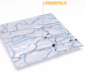 Places with similar names to Lengenfeld, Austria ::
// Langenfelde (DE)
// Langenfelde (DE)
// Langenfeld (DE)
// Langenfeld (DE)
// Langenfeld (DE)
// Langenfeld (DE)
// Langenfelde (DE)
// Langenfelde (DE)
// Lengenfeld (DE)
// Lengenfeld (DE)
Disclaimer :: Information on this page comes without warranty of any kind |
||
|
Where is Lengenfeld? Elevation and coordinates ::
Latitude (lat): 48°28'0"N Longitude (lon): 15°35'0"E
Elevation (approx.): 344m (map arrows pan, magnifying glasses zoom) |
||
|
Visiting Lengenfeld? Hotel/Accommodation ::
Book a hotel in Lengenfeld Travel Guide ::
Buy a travel guide for Austria rental cars ::
car rental offers GPS waypoint ::
download a GPX waypoint (PoI) of Lengenfeld for your GPS receiver
|
||