|
search place name
|
||
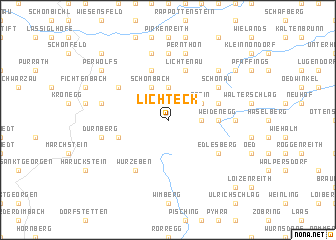
Lichteck (Niederösterreich, Austria)Lichteck is a town in the Niederösterreich region of Austria. An overview map of the region around Lichteck is displayed below.
regional and 3d topo map of Lichteck, Austria ::
Lichteck airports ::
The nearest airport is LNZ - Linz (Horsching), located 67.1 km west of Lichteck.
Other airports nearby include VIE - Vienna Schwechat (117.9 km east), BRQ - Turany (145.9 km north east), GRZ - Graz (161.2 km south), PED - Pardubice (184.5 km north), Nearby towns ::
Prettlers (2.5km east) //
Dorfstadt (3.7km north) //
Stein (3.1km north east) //
Schönbach (3.9km north) //
Weidenegg (3.7km east) //
Traunstein (4.1km north east) //
Lichtenau (5.7km north) //
Lengau (5.7km north) //
Bärnkopf (4.1km south west) //
Wurzeben (6.1km south west) //
Schönau (5.2km north east) //
Kleinsiegharts (5.2km north west) //
Edlesberg (5.2km south east) //
Lohn (7.4km north) //
Gürtelberg (4.9km east) //
Grub im Thale (7.5km north) //
Pehendorf (7.5km north) //
Pernthon (7.5km north) //
Grosspertenschlag (5.3km west) //
Dürnberg (5.3km west) //
Aschen (6.7km north east) //
Grosshummelberg (7.4km north east) //
Perwolfs (7.4km north west) //
Etlas (8.9km north west) //
Neumelon (8.9km north west) //
Gutenbrunn (8.9km south east) //
[all distances 'as the bird flies' and approximate]  Places with similar names to Lichteck, Austria ::
// Leshtak (BG)
// La Chatqueue (BE)
Disclaimer :: Information on this page comes without warranty of any kind |
||
|
Where is Lichteck? Elevation and coordinates ::
Latitude (lat): 48°25'0"N Longitude (lon): 15°3'0"E
Elevation (approx.): 955m (map arrows pan, magnifying glasses zoom) |
||
|
Visiting Lichteck? Hotel/Accommodation ::
Book a hotel in Lichteck Travel Guide ::
Buy a travel guide for Austria rental cars ::
car rental offers GPS waypoint ::
download a GPX waypoint (PoI) of Lichteck for your GPS receiver
|
||