|
search place name
|
||
Lindenberg (Oberösterreich, Austria)Lindenberg is a town in the Oberösterreich region of Austria. An overview map of the region around Lindenberg is displayed below.
regional and 3d topo map of Lindenberg, Austria ::

Lindenberg airports ::
The nearest airport is LNZ - Linz (Horsching), located 58.8 km south east of Lindenberg.
Other airports nearby include SZG - Salzburg (89.0 km south west), MUC - Munich Munchen (129.3 km west), PRG - Prague Ruzyne (184.3 km north), KLV - Karlovy Vary (192.6 km north), Nearby towns ::
Buchet (0.2km north) //
Thaling (0.7km south east) //
Oberham (0.9km north east) //
Schwendt (1.2km north) //
Kugelbuchet (1.6km north) //
Würm (1.6km north east) //
Kubing (1.2km west) //
Steinbrunn (1.2km west) //
Schönbach (1.2km east) //
Edt (1.3km south west) //
Berg (1.3km west) //
Anzberg (1.8km south) //
Wideck (1.4km north east) //
Kinham (1.8km south west) //
Edt (2.0km north) //
Straß (1.6km south east) //
Wühr (2.0km north west) //
Schatzedt (1.7km east) //
Peham (2.6km north) //
Asing (2.2km north east) //
Winkl (2.2km north west) //
Schardenberg (2.2km north west) //
Reitern (2.2km south east) //
Hueb (2.0km north west) //
Kneiding (1.9km east) //
Bach (2.9km north) //
Wibling (2.0km west) //
Außerhareth (2.9km north) //
Neudorf (2.8km north west) //
[all distances 'as the bird flies' and approximate] 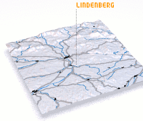 Places with similar names to Lindenberg, Austria ::
// Lindenberg (DE)
// Lindenberg (DE)
// Lindenberg (DE)
// Lindenberg (DE)
// Lindenberg (DE)
// Lindenberg (DE)
// Lindenberg (DE)
// Lindenbrück (DE)
// Lindenberg (DE)
// Lindenberg (DE)
Disclaimer :: Information on this page comes without warranty of any kind |
||
|
Where is Lindenberg? Elevation and coordinates ::
Latitude (lat): 48°31'0"N Longitude (lon): 13°31'0"E
Elevation (approx.): 494m (map arrows pan, magnifying glasses zoom) |
||
|
Visiting Lindenberg? Hotel/Accommodation ::
Book a hotel in Lindenberg Travel Guide ::
Buy a travel guide for Austria rental cars ::
car rental offers GPS waypoint ::
download a GPX waypoint (PoI) of Lindenberg for your GPS receiver
|
||