|
search place name
|
||
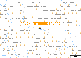
Rauchwart im Burgenland (Burgenland, Austria)Rauchwart im Burgenland is a town in the Burgenland region of Austria. An overview map of the region around Rauchwart im Burgenland is displayed below.
regional and 3d topo map of Rauchwart im Burgenland, Austria ::
Rauchwart im Burgenland airports ::
The nearest airport is GRZ - Graz, located 62.3 km west of Rauchwart im Burgenland.
Other airports nearby include MBX - Maribor (83.8 km south west), VIE - Vienna Schwechat (111.5 km north), BTS - Bratislava M R Stefanik (136.8 km north east), KLU - Klagenfurt (Worthersee Intl) (154.4 km west), Nearby towns ::
Schallendorf im Burgenland (2.2km south east) //
Sankt Michael im Burgenland (2.5km east) //
Gamischdorf (3.9km south) //
Mitterneuberg (3.9km north) //
Unterneuberg (3.9km north) //
Oberneuberg (3.9km north) //
Eisenhüttl (4.5km south west) //
Rehgraben (5.6km south) //
Heugraben (4.2km south west) //
Hackenberg (5.7km south) //
Tudersdorf (5.3km south east) //
Deutsch Tschantschendorf (5.3km south east) //
Neusiedl bei Güssing (5.3km south west) //
Olbendorf (6.1km north west) //
Bocksdorf (5.0km west) //
Jokischberg (7.5km south) //
Kukmirn (7.5km south) //
Rohr im Burgenland (5.4km west) //
Gerersdorf bei Güssing (7.5km south) //
Kroatisch Tschantschendorf (6.7km south east) //
Sulz im Burgenland (7.8km south) //
Steingraben (7.8km south) //
Stegersbach (6.3km north west) //
Güttenbach (6.3km north east) //
Ollersdorf im Burgenland (7.5km north west) //
Hasendorf im Burgenland (7.5km south east) //
Tobaj (7.5km south east) //
Rohrbach an der Teich (8.3km north east) //
Limbach im Burgenland (9.0km south west) //
[all distances 'as the bird flies' and approximate]  Places with similar names to Rauchwart im Burgenland, Austria :: Disclaimer :: Information on this page comes without warranty of any kind |
||
|
Where is Rauchwart im Burgenland? Elevation and coordinates ::
Latitude (lat): 47°8'0"N Longitude (lon): 16°14'0"E
Elevation (approx.): 232m (map arrows pan, magnifying glasses zoom) |
||
|
Visiting Rauchwart im Burgenland? Hotel/Accommodation ::
Book a hotel in Rauchwart im Burgenland Travel Guide ::
Buy a travel guide for Austria rental cars ::
car rental offers GPS waypoint ::
download a GPX waypoint (PoI) of Rauchwart im Burgenland for your GPS receiver
|
||