|
search place name
|
||
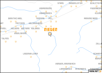
Rieder (Tirol, Austria)Rieder is a town in the Tirol region of Austria. An overview map of the region around Rieder is displayed below.
regional and 3d topo map of Rieder, Austria ::
Rieder airports ::
The nearest airport is INN - Innsbruck, located 25.7 km west of Rieder.
Other airports nearby include BZO - Bolzano (93.7 km south), OBF - Oberpfaffenhofen (95.4 km north), FEL - Fuerstenfeldbruck Furstenfeldbruck (109.0 km north), SZG - Salzburg (115.4 km north east), Nearby towns ::
Ausserweerberg (3.7km north) //
Mitterweerberg (3.9km north) //
Innerweerberg (3.9km north) //
Pill (5.6km north) //
Niederpillberg (5.6km north) //
Kolsass (4.2km north west) //
Hochpillberg (5.7km north) //
Weer (5.3km north west) //
Kolsassberg (5.3km north west) //
Terfens (6.1km north west) //
Vomp (7.4km north) //
Vomperbach (7.5km north) //
Pirchanger (7.5km north) //
Arzberg (7.5km north) //
Schwaz (7.5km north) //
Umlberg (8.3km north west) //
Lager Walchen (9.0km south west) //
[all distances 'as the bird flies' and approximate]  Places with similar names to Rieder, Austria ::
Disclaimer :: Information on this page comes without warranty of any kind |
||
|
Where is Rieder? Elevation and coordinates ::
Latitude (lat): 47°16'0"N Longitude (lon): 11°41'0"E
Elevation (approx.): 1129m (map arrows pan, magnifying glasses zoom) |
||
|
Visiting Rieder? Hotel/Accommodation ::
Book a hotel in Rieder Travel Guide ::
Buy a travel guide for Austria rental cars ::
car rental offers GPS waypoint ::
download a GPX waypoint (PoI) of Rieder for your GPS receiver
|
||