|
search place name
|
||
Schallenberg (Oberösterreich, Austria)Schallenberg is a town in the Oberösterreich region of Austria. An overview map of the region around Schallenberg is displayed below.
regional and 3d topo map of Schallenberg, Austria ::

Schallenberg airports ::
The nearest airport is LNZ - Linz (Horsching), located 28.9 km south of Schallenberg.
Other airports nearby include SZG - Salzburg (117.7 km south west), PRG - Prague Ruzyne (178.9 km north), GRZ - Graz (191.4 km south east), PED - Pardubice (203.1 km north east), Nearby towns ::
Kleintraberg (1.0km north east) //
Oberwaldschlag (1.0km north east) //
Grosstraberg (1.0km north east) //
Höf (1.1km west) //
Punzing (1.8km south) //
Froschau (2.4km south) //
Unterrechberg (1.7km west) //
Wögersdorf (2.5km south west) //
Oberbrunnwald (2.7km north) //
Obertraberg (2.7km north) //
Rechberg (2.0km north west) //
Amesschlag (2.1km south east) //
Grubdorf-Siedlung (2.5km south west) //
Königsdorf (3.0km south) //
Waxenberg (3.0km south) //
Mitterfeld (3.2km south) //
Königsdorf (3.4km south) //
Fuchsgraben (2.7km south east) //
Schaffetschlag (3.0km south east) //
Mitterbrunnwald (3.2km north east) //
Kepling (3.5km south west) //
Königsberg (3.5km south east) //
In der Au (3.4km south east) //
Reindlsedt (4.5km south) //
Bernhardschlag (4.5km north) //
Unterbrunnwald (3.2km east) //
Unterwaldschlag (3.2km east) //
Schauerschlag (3.3km east) //
Windhag (3.3km west) //
[all distances 'as the bird flies' and approximate] 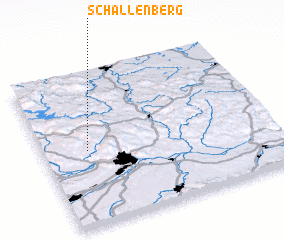 Places with similar names to Schallenberg, Austria ::
// Schallenburg (DE)
// Schelenburg (DE)
// Schellenberg (DE)
// Schellenberg (DE)
// Schellenberg (DE)
// Schellenberg (DE)
// Schellenberg (DE)
// Schulenberg (DE)
// Schulenberg (DE)
// Schulenburg (DE)
Disclaimer :: Information on this page comes without warranty of any kind |
||
|
Where is Schallenberg? Elevation and coordinates ::
Latitude (lat): 48°29'35"N Longitude (lon): 14°11'30"E
Elevation (approx.): 797m (map arrows pan, magnifying glasses zoom) |
||
|
Visiting Schallenberg? Hotel/Accommodation ::
Book a hotel in Schallenberg Travel Guide ::
Buy a travel guide for Austria rental cars ::
car rental offers GPS waypoint ::
download a GPX waypoint (PoI) of Schallenberg for your GPS receiver
|
||