|
search place name
|
||
Sterzen (Kärnten, Austria)Sterzen is a town in the Kärnten region of Austria. An overview map of the region around Sterzen is displayed below.
regional and 3d topo map of Sterzen, Austria ::

Sterzen airports ::
The nearest airport is AVB - Aviano Ab (Pagliano E Gori), located 75.2 km south of Sterzen.
Other airports nearby include TRS - Ronchi De Legionari Ronchi Dei Legionari (111.8 km south east), BZO - Bolzano (112.3 km west), KLU - Klagenfurt (Worthersee Intl) (121.7 km east), SZG - Salzburg (123.1 km north), Nearby towns ::
Moos (0.3km south) //
Maria Luggau (1.1km north west) //
Wiesen (1.3km east) //
Tiefenbach (1.3km west) //
Raut (1.3km west) //
Frohn (1.4km south east) //
Tuffbad (3.0km north east) //
Sankt Lorenzen im Lesachtal (2.6km east) //
Sallach (3.1km north west) //
Guggenberg (3.1km north west) //
Untertilliach (3.2km west) //
Untertscheltsch (5.1km east) //
Liesing (5.3km east) //
[all distances 'as the bird flies' and approximate] 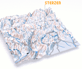 Places with similar names to Sterzen, Austria ::
// Starosanny (RU)
// Storozhno (RU)
// Zaderzhnyy (RU)
// Zadorozhnyy (RU)
// Zadorozhnyy (RU)
// Strassen (AT)
// Striesenow (DE)
// Strießen (DE)
// Strasen (DE)
// Straßen (DE)
Disclaimer :: Information on this page comes without warranty of any kind |
||
|
Where is Sterzen? Elevation and coordinates ::
Latitude (lat): 46°42'0"N Longitude (lon): 12°45'0"E
Elevation (approx.): 1118m (map arrows pan, magnifying glasses zoom) |
||
|
Visiting Sterzen? Hotel/Accommodation ::
Book a hotel in Sterzen Travel Guide ::
Buy a travel guide for Austria rental cars ::
car rental offers GPS waypoint ::
download a GPX waypoint (PoI) of Sterzen for your GPS receiver
|
||