|
search place name
|
||
Unterberg (Tirol, Austria)Unterberg is a town in the Tirol region of Austria. An overview map of the region around Unterberg is displayed below.
regional and 3d topo map of Unterberg, Austria ::

Unterberg airports ::
The nearest airport is INN - Innsbruck, located 44.2 km south west of Unterberg.
Other airports nearby include OBF - Oberpfaffenhofen (72.9 km north west), FEL - Fuerstenfeldbruck Furstenfeldbruck (85.5 km north west), MUC - Munich Munchen (92.6 km north), SZG - Salzburg (96.4 km east), Nearby towns ::
Vordersteinberg (0.5km south east) //
Obersteinberg (1.6km south east) //
Außersteinberg (3.0km east) //
Hinterberg (3.6km east) //
Leiten (6.2km north west) //
[all distances 'as the bird flies' and approximate] 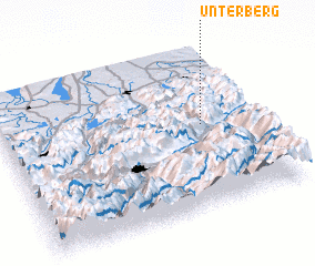 Places with similar names to Unterberg, Austria ::
Disclaimer :: Information on this page comes without warranty of any kind |
||
|
Where is Unterberg? Elevation and coordinates ::
Latitude (lat): 47°31'14"N Longitude (lon): 11°47'11"E
Elevation (approx.): 996m (map arrows pan, magnifying glasses zoom) |
||
|
Visiting Unterberg? Hotel/Accommodation ::
Book a hotel in Unterberg Travel Guide ::
Buy a travel guide for Austria rental cars ::
car rental offers GPS waypoint ::
download a GPX waypoint (PoI) of Unterberg for your GPS receiver
|
||