|
search place name
|
||
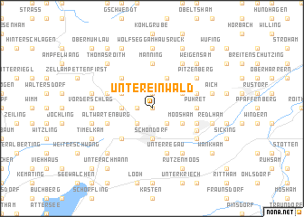
Untereinwald (Oberösterreich, Austria)Untereinwald is a town in the Oberösterreich region of Austria. An overview map of the region around Untereinwald is displayed below.
regional and 3d topo map of Untereinwald, Austria ::
nearby GPS traces from timatio ::
Untereinwald airports ::
The nearest airport is LNZ - Linz (Horsching), located 44.7 km north east of Untereinwald.
Other airports nearby include SZG - Salzburg (56.2 km south west), MUC - Munich Munchen (144.3 km west), KLU - Klagenfurt (Worthersee Intl) (162.7 km south), GRZ - Graz (176.8 km south east), Nearby towns ::
Oberpilsbach (0.0km north) //
Schmidham (1.9km north) //
Mittereinwald (1.2km west) //
Unterpilsbach (2.2km south east) //
Vöcklabruck (2.2km south west) //
Schöndorf (3.7km south) //
Schalchham (3.7km south) //
Obereinwald (2.5km west) //
Moosham (3.1km south east) //
Altensam (3.1km north east) //
Köppach (3.9km north) //
Fuchsberg (3.1km north west) //
Englsheim (3.1km north west) //
Oberthalheim (4.5km south west) //
Natternberg (4.5km north west) //
Manning (5.6km north) //
Pühret (3.7km east) //
Attnang (4.2km south east) //
Altwartenburg (4.2km south west) //
Oberregau (5.7km south) //
Unterregau (5.7km south) //
Rutzenham (4.2km north east) //
Ungenach (4.2km north west) //
Attnang-Puchheim (4.6km south east) //
Atzbach (6.1km north east) //
Puchheim (5.3km south east) //
Preising (6.1km south east) //
Pitzenberg (5.2km north east) //
Oberottnang (7.4km north) //
[all distances 'as the bird flies' and approximate] 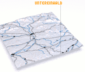 Places with similar names to Untereinwald, Austria :: Disclaimer :: Information on this page comes without warranty of any kind |
||
|
Where is Untereinwald? Elevation and coordinates ::
Latitude (lat): 48°2'0"N Longitude (lon): 13°40'0"E
Elevation (approx.): 471m (map arrows pan, magnifying glasses zoom) |
||
|
Visiting Untereinwald? Hotel/Accommodation ::
Book a hotel in Untereinwald Travel Guide ::
Buy a travel guide for Austria rental cars ::
car rental offers GPS waypoint ::
download a GPX waypoint (PoI) of Untereinwald for your GPS receiver
|
||