|
search place name
|
||
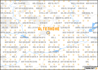
Altenhöhe (Nordrhein-Westfalen, Germany)Altenhöhe is a town in the Nordrhein-Westfalen region of Germany. An overview map of the region around Altenhöhe is displayed below.
regional and 3d topo map of Altenhöhe, Germany ::
Altenhöhe airports ::
The nearest airport is CGN - Cologne Koln Bonn, located 30.4 km south of Altenhöhe.
Other airports nearby include ESS - Essen Mulheim (36.4 km north west), DUS - Duesseldorf Dusseldorf (36.9 km north west), DTM - Dortmund (50.3 km north east), MGL - Moenchengladbach Monchengladbach (52.1 km west), Nearby towns ::
Süppelbach (0.0km north) //
Elbringhausen (0.0km north) //
Asmannskotten (1.9km south) //
Eipringhausen (1.9km south) //
Kallenberg (1.2km east) //
Buchholzen (1.2km east) //
Kovelsberg (1.2km east) //
Durholzen (1.2km east) //
Neuenhöhe (1.9km north) //
Wüstenhof (1.9km north) //
Lüffringhausen (1.9km north) //
Eckringhausen (2.2km south west) //
Finkenholl (2.2km south west) //
Im Berg (2.2km south west) //
Wöllersberg (2.2km south west) //
Hoffnung (2.2km south west) //
Well (2.2km south east) //
Niederrautenbach (2.2km south east) //
Wickhausen (2.2km south east) //
Habenichts (2.2km south east) //
Oberrautenbach (2.2km south east) //
Wermelskirchen (2.2km north west) //
Töckelhausen (2.2km north east) //
Buchholzen (2.2km north east) //
Bergisch Born (2.2km north east) //
Eichholz (3.7km south) //
Sonne (3.7km south) //
Osminghausen (3.7km south) //
Bollinghausen (2.3km west) //
[all distances 'as the bird flies' and approximate] 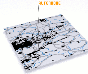 Places with similar names to Altenhöhe, Germany :: Disclaimer :: Information on this page comes without warranty of any kind |
||
|
Where is Altenhöhe? Elevation and coordinates ::
Latitude (lat): 51°8'0"N Longitude (lon): 7°14'0"E
Elevation (approx.): 308m (map arrows pan, magnifying glasses zoom) |
||
|
Visiting Altenhöhe? Hotel/Accommodation ::
Book a hotel in Altenhöhe Travel Guide ::
Buy a travel guide for Germany rental cars ::
car rental offers GPS waypoint ::
download a GPX waypoint (PoI) of Altenhöhe for your GPS receiver
|
||