|
search place name
|
||
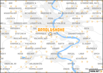
Arnoldshöhe (Nordrhein-Westfalen, Germany)Arnoldshöhe is a town in the Nordrhein-Westfalen region of Germany. An overview map of the region around Arnoldshöhe is displayed below.
regional and 3d topo map of Arnoldshöhe, Germany ::
nearby GPS traces from timatio ::
Arnoldshöhe airports ::
The nearest airport is CGN - Cologne Koln Bonn, located 13.0 km east of Arnoldshöhe.
Other airports nearby include DUS - Duesseldorf Dusseldorf (45.5 km north), MGL - Moenchengladbach Monchengladbach (49.0 km north west), ESS - Essen Mulheim (55.9 km north), GKE - Geilenkirchen (65.3 km west), Nearby towns ::
Raderberg (0.0km north) //
Marienburg (1.2km east) //
Poll (1.2km east) //
Raderthal (1.2km west) //
Großrott (1.9km south) //
Rodenkirchen (2.2km south east) //
Bayenthal (2.2km north east) //
Schillingsrott (2.2km south east) //
Zollstock (2.2km north west) //
Giesdorf (3.7km south) //
Rondorf (3.7km south) //
Hahnwald (3.7km south) //
Hönningen (2.3km west) //
Deutz (3.9km north) //
Humboldtkolonie (3.9km north) //
Köln (3.9km north) //
Hochkirchen (3.0km south west) //
Langel (4.4km south east) //
Sürth (4.4km south east) //
Meschenich (4.4km south west) //
Westhoven (3.5km east) //
Riehl (5.6km north) //
Godorf (5.7km south) //
Immendorf (5.7km south) //
Sülz (4.0km north west) //
Klettenberg (4.0km north west) //
Lindenthal (5.1km north west) //
Kalk (6.0km north east) //
Ensen (4.7km east) //
[all distances 'as the bird flies' and approximate] 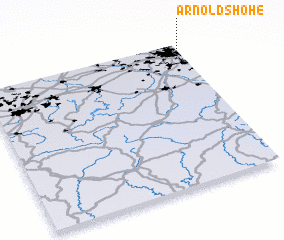 Places with similar names to Arnoldshöhe, Germany :: Disclaimer :: Information on this page comes without warranty of any kind |
||
|
Where is Arnoldshöhe? Elevation and coordinates ::
Latitude (lat): 50°54'0"N Longitude (lon): 6°58'0"E
Elevation (approx.): 55m (map arrows pan, magnifying glasses zoom) |
||
|
Visiting Arnoldshöhe? Hotel/Accommodation ::
Book a hotel in Arnoldshöhe Travel Guide ::
Buy a travel guide for Germany rental cars ::
car rental offers GPS waypoint ::
download a GPX waypoint (PoI) of Arnoldshöhe for your GPS receiver
|
||