|
search place name
|
||
Auderath (Rheinland-Pfalz, Germany)Auderath is a town in the Rheinland-Pfalz region of Germany. An overview map of the region around Auderath is displayed below.
regional and 3d topo map of Auderath, Germany ::

Auderath airports ::
The nearest airport is SPM - Spangdahlem Ab, located 32.1 km south west of Auderath.
Other airports nearby include HHN - Frankfurt Hahn (32.2 km south east), ZQF - Trier Fohren (38.7 km south west), ZNV - Koblenz Winningen (40.9 km north east), CGN - Cologne Koln Bonn (76.6 km north), Nearby towns ::
Filz (2.2km south west) //
Schmitt (2.2km south east) //
Alflen (2.4km east) //
Meiserich (3.0km north west) //
Wollmerath (3.9km south) //
Gillenbeuren (3.9km south) //
Wagenhausen (3.9km south) //
Ulmen (3.9km north) //
Vorpochten (3.9km north) //
Furth (4.4km north west) //
Demerath (3.6km west) //
Lutzerath (5.6km south) //
Kölnische Höfe (5.7km north) //
Driesch (5.7km south) //
Winkel (5.1km south west) //
Niederwinkel (5.1km south west) //
Oberwinkel (5.1km south west) //
Schönbach (5.1km north west) //
Höchstberg (7.4km north) //
Gunderath (7.5km north) //
Kötterichen (7.5km north) //
Uersfeld (7.5km north) //
Berenbach (6.6km north west) //
Immerath (6.6km south west) //
Kaperich (7.8km north) //
Lirstal (7.8km north) //
Utzerath (6.0km north west) //
Müllenbach (6.0km north east) //
Kliding (8.2km south east) //
[all distances 'as the bird flies' and approximate] 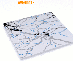 Places with similar names to Auderath, Germany :: Disclaimer :: Information on this page comes without warranty of any kind |
||
|
Where is Auderath? Elevation and coordinates ::
Latitude (lat): 50°11'0"N Longitude (lon): 7°0'0"E
Elevation (approx.): 452m (map arrows pan, magnifying glasses zoom) |
||
|
Visiting Auderath? Hotel/Accommodation ::
Book a hotel in Auderath Travel Guide ::
Buy a travel guide for Germany rental cars ::
car rental offers GPS waypoint ::
download a GPX waypoint (PoI) of Auderath for your GPS receiver
|
||