|
search place name
|
||
Bachtels (Bayern, Germany)Bachtels is a town in the Bayern region of Germany. An overview map of the region around Bachtels is displayed below.
regional and 3d topo map of Bachtels, Germany ::

Bachtels airports ::
The nearest airport is FDH - Friedrichshafen, located 52.7 km west of Bachtels.
Other airports nearby include ACH - St Gallen Altenrhein (57.3 km south west), OBF - Oberpfaffenhofen (88.2 km north east), AGB - Augsburg (91.3 km north east), FEL - Fuerstenfeldbruck Furstenfeldbruck (93.4 km north east), Nearby towns ::
Millers (0.0km north) //
Himo (1.9km north) //
Winnings (1.2km east) //
Bodenwalz (1.2km west) //
Bailers (1.2km east) //
Trunzen (1.2km east) //
Eckartsberg (1.2km east) //
Schwarzachen (1.9km south) //
Dezion (2.2km north west) //
Wäschers (2.2km north east) //
Völken (2.2km north east) //
Weihers (2.2km north east) //
Bronnen (2.2km north west) //
Ried (2.2km north east) //
Bräunlings (2.2km north west) //
Westenried (2.2km south east) //
Egg (2.2km south east) //
Geisemers (3.7km north) //
Oberhub (3.7km north) //
Käsers (3.7km north) //
Unterhub (3.7km north) //
Walzlings (2.5km west) //
Buchen (2.5km west) //
Mayrhof (2.5km east) //
Hahnenberg (2.5km east) //
Frohnhofen (2.5km east) //
Hohenrad (2.5km east) //
Brand (3.1km north west) //
Spöck (3.1km north west) //
[all distances 'as the bird flies' and approximate] 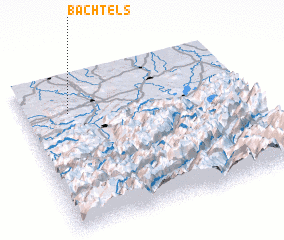 Places with similar names to Bachtels, Germany :: Disclaimer :: Information on this page comes without warranty of any kind |
||
|
Where is Bachtels? Elevation and coordinates ::
Latitude (lat): 47°46'0"N Longitude (lon): 10°12'0"E
Elevation (approx.): 868m (map arrows pan, magnifying glasses zoom) |
||
|
Visiting Bachtels? Hotel/Accommodation ::
Book a hotel in Bachtels Travel Guide ::
Buy a travel guide for Germany rental cars ::
car rental offers GPS waypoint ::
download a GPX waypoint (PoI) of Bachtels for your GPS receiver
|
||