|
search place name
|
||
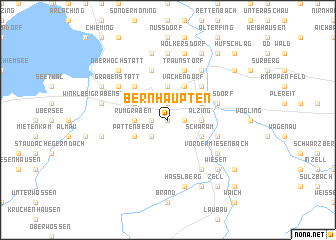
Bernhaupten (Bayern, Germany)Bernhaupten is a town in the Bayern region of Germany. An overview map of the region around Bernhaupten is displayed below.
regional and 3d topo map of Bernhaupten, Germany ::
nearby GPS traces from timatio ::
Bernhaupten airports ::
The nearest airport is SZG - Salzburg, located 30.4 km east of Bernhaupten.
Other airports nearby include MUC - Munich Munchen (85.1 km north west), OBF - Oberpfaffenhofen (102.7 km west), FEL - Fuerstenfeldbruck Furstenfeldbruck (108.5 km north west), INN - Innsbruck (113.0 km south west), Nearby towns ::
Bergen (0.0km north) //
Hasperting (1.9km north) //
Adelholzen (1.2km east) //
Stocka (1.2km west) //
Weißachen (2.2km south west) //
Mühlwinkl (2.2km south west) //
Maximilianshütte (2.2km south west) //
Rumgraben (2.5km west) //
Untersiegsdorf (2.5km east) //
Alzing (2.5km east) //
Mühlen (3.7km north) //
Spielwang (3.7km north) //
Wörglham (3.7km north) //
Holzhausen (3.1km north west) //
Traundorf (3.1km north east) //
Pattenberg (3.1km south west) //
Scharam (3.1km south east) //
Eisenärzt (3.1km south east) //
Axdorf (3.9km north) //
Vachendorf (3.9km north) //
Marwang (4.5km north west) //
Wimpasing (4.5km north east) //
Siegsdorf (4.2km north east) //
Hörgering (4.2km south east) //
Einham (5.7km north) //
Traunstorf (5.7km north) //
Tettenmoos (5.7km north) //
Buchschachen (6.1km south east) //
Grabenstätt (5.3km north west) //
[all distances 'as the bird flies' and approximate] 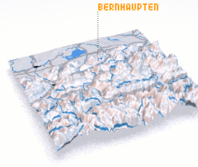 Places with similar names to Bernhaupten, Germany :: Disclaimer :: Information on this page comes without warranty of any kind |
||
|
Where is Bernhaupten? Elevation and coordinates ::
Latitude (lat): 47°49'0"N Longitude (lon): 12°36'0"E
Elevation (approx.): 557m (map arrows pan, magnifying glasses zoom) |
||
|
Visiting Bernhaupten? Hotel/Accommodation ::
Book a hotel in Bernhaupten Travel Guide ::
Buy a travel guide for Germany rental cars ::
car rental offers GPS waypoint ::
download a GPX waypoint (PoI) of Bernhaupten for your GPS receiver
|
||