|
search place name
|
||
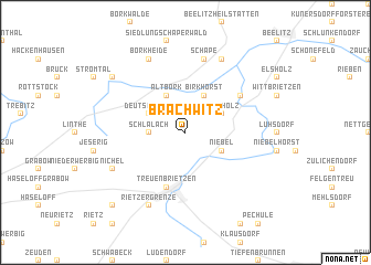
Brachwitz (Brandenburg, Germany)Brachwitz is a town in the Brandenburg region of Germany. An overview map of the region around Brachwitz is displayed below.
regional and 3d topo map of Brachwitz, Germany ::
Brachwitz airports ::
The nearest airport is THF - Berlin Tempelhof, located 50.5 km north east of Brachwitz.
Other airports nearby include SXF - Berlin Schonefeld (50.6 km north east), TXL - Berlin Tegel (53.3 km north east), LEJ - Leipzig Halle (91.3 km south west), DRS - Dresden (128.7 km south east), Nearby towns ::
Schlalach (2.3km west) //
Alt Bork (3.9km north) //
Deutsch Bork (2.9km north west) //
Birkhorst (3.9km north) //
Buchholz (2.9km north east) //
Niebel (2.9km south east) //
Treuenbrietzen (5.7km south) //
Salzbrunn (5.0km north east) //
Schäpe (7.5km north) //
Nichel (5.9km south west) //
Borkheide (7.8km north) //
Rietzer Grenze (7.8km south) //
Reesdorf (7.8km north) //
Neuendorf (7.2km north west) //
Rietzerbucht (8.7km south west) //
[all distances 'as the bird flies' and approximate] 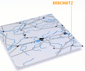 Places with similar names to Brachwitz, Germany ::
// Braschwitz (DE)
// Brachwitz (DE)
Disclaimer :: Information on this page comes without warranty of any kind |
||
|
Where is Brachwitz? Elevation and coordinates ::
Latitude (lat): 52°9'0"N Longitude (lon): 12°53'0"E
Elevation (approx.): 42m (map arrows pan, magnifying glasses zoom) |
||
|
Visiting Brachwitz? Hotel/Accommodation ::
Book a hotel in Brachwitz Travel Guide ::
Buy a travel guide for Germany rental cars ::
car rental offers GPS waypoint ::
download a GPX waypoint (PoI) of Brachwitz for your GPS receiver
|
||