|
search place name
|
||
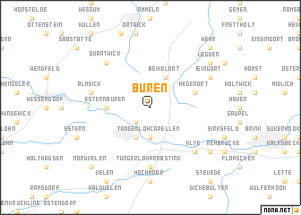
Büren (Nordrhein-Westfalen, Germany)Büren is a town in the Nordrhein-Westfalen region of Germany. An overview map of the region around Büren is displayed below.
regional and 3d topo map of Büren, Germany ::
Büren airports ::
The nearest airport is ENS - Enschede Twenthe, located 33.7 km north of Büren.
Other airports nearby include FMO - Muenster/osnabrueck Munster Osnabruck (47.8 km east), ESS - Essen Mulheim (65.0 km south), DTM - Dortmund (65.4 km south east), DUS - Duesseldorf Dusseldorf (79.4 km south), Nearby towns ::
Harwick (2.2km south west) //
Tungerloh-Capellen (3.7km south) //
Gescher (3.9km south) //
Beikelort (3.9km north) //
Estern-Büren (3.4km west) //
Hegerort (3.9km north east) //
Tungerloh-Pröbsting (7.4km south) //
Almsick (4.9km west) //
Klye (6.5km south east) //
Quantwick (6.5km north west) //
Isingort (5.9km north east) //
Goxel (7.2km south east) //
Legden (7.2km north east) //
Nordvelen (8.7km south west) //
Wehr (8.7km north east) //
[all distances 'as the bird flies' and approximate] 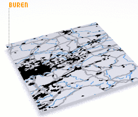 Places with similar names to Büren, Germany ::
Disclaimer :: Information on this page comes without warranty of any kind |
||
|
Where is Büren? Elevation and coordinates ::
Latitude (lat): 51°59'0"N Longitude (lon): 7°2'0"E
Elevation (approx.): 71m (map arrows pan, magnifying glasses zoom) |
||
|
Visiting Büren? Hotel/Accommodation ::
Book a hotel in Büren Travel Guide ::
Buy a travel guide for Germany rental cars ::
car rental offers GPS waypoint ::
download a GPX waypoint (PoI) of Büren for your GPS receiver
|
||