|
search place name
|
||
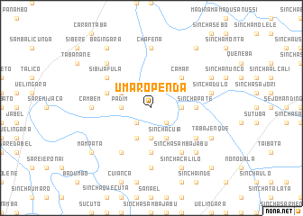
Umaro Penda (Guinea-Bissau)Umaro Penda is a town in Guinea-Bissau. An overview map of the region around Umaro Penda is displayed below.
regional and 3d topo map of Umaro Penda, Guinea-Bissau ::
Umaro Penda airports ::
The nearest airport is BXO - Bissau Oswaldo Vieira Intl, located 151.2 km south west of Umaro Penda.
Other airports nearby include TUD - Tambacounda (158.4 km north east), ZIG - Ziguinchor (202.8 km west), KLC - Kaolack (252.8 km north west), Nearby towns ::
Saliquinhé (2.6km south west) //
Sinchã Nhoncó (2.6km south east) //
Sinchã Braíma (2.6km south east) //
Padim (3.6km west) //
Panalicha (3.6km east) //
Carura Cherno (3.7km south) //
Carura Samba Baldè (3.7km south) //
Sibijã Mandinga (4.1km north west) //
Saliquinhé (4.1km south west) //
Sinchã Cuia (4.1km south east) //
Camar (5.2km north east) //
Sinchã Pátè (5.4km east) //
Sambacunda (5.6km south) //
Madina Bantael (5.7km west) //
Sibijã Fula (6.6km north west) //
Madina Samba (6.6km south west) //
Sinchã Talata (6.6km south east) //
Sinchã Samba Jabu (6.6km south east) //
Sinchã Patè Curé (6.6km south east) //
Janá Iáià (6.6km south east) //
Janã Marena (6.6km south east) //
Cambem (7.2km west) //
Chafena (7.4km north) //
Ierocunda (7.4km south) //
Marecunda (7.5km east) //
Sinchã Dulò (7.5km east) //
Sinchã Malam (7.8km north west) //
Cudum Govêrno (7.8km south east) //
Cantaelcunda (8.1km north east) //
[all distances 'as the bird flies' and approximate] 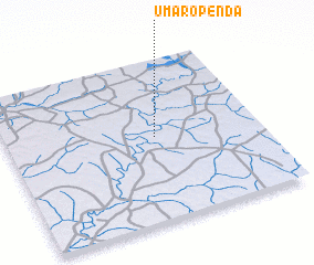 Places with similar names to Umaro Penda, Guinea-Bissau :: Disclaimer :: Information on this page comes without warranty of any kind |
||
|
Where is Umaro Penda? Elevation and coordinates ::
Latitude (lat): 12°31'0"N Longitude (lon): 14°25'0"W
Elevation (approx.): 20m (map arrows pan, magnifying glasses zoom) |
||
|
Visiting Umaro Penda? Hotel/Accommodation ::
Book a hotel in Umaro Penda Travel Guide ::
rental cars ::
car rental offers GPS waypoint ::
download a GPX waypoint (PoI) of Umaro Penda for your GPS receiver
|
||