|
search place name
|
||
Daufenbach (Rheinland-Pfalz, Germany)Daufenbach is a town in the Rheinland-Pfalz region of Germany. An overview map of the region around Daufenbach is displayed below.
regional and 3d topo map of Daufenbach, Germany ::

Daufenbach airports ::
The nearest airport is ZQF - Trier Fohren, located 10.2 km east of Daufenbach.
Other airports nearby include SPM - Spangdahlem Ab (10.4 km north), LUX - Luxemburg Luxembourg (42.6 km south west), HHN - Frankfurt Hahn (44.7 km east), ZNV - Koblenz Winningen (79.8 km north east), Nearby towns ::
Schleidweiler (1.2km east) //
Orenhofen (1.9km north) //
Rodt (2.2km south east) //
Hofweiler (3.0km south west) //
Hochmark (3.9km south) //
Auw (3.0km north west) //
Hosten (3.0km north west) //
Preist (3.9km north) //
Kyll (3.6km west) //
Ittel (4.0km south west) //
Kordel (5.7km south) //
Zemmer (4.0km north east) //
Speicher (5.7km north) //
Dahlem (5.2km north west) //
Ordorf (7.5km south) //
Philippsheim (7.5km north) //
Beilingen (7.5km north) //
Bleischmelz (6.6km south east) //
Quint (6.6km south east) //
Kimmlingerhof (6.6km south west) //
Ehrang (7.8km south) //
Butzweiler (7.8km south) //
Trimport (6.0km north west) //
Möhn (7.3km south west) //
Röhl (7.3km north west) //
Herforst (8.2km north east) //
Newel (8.8km south west) //
[all distances 'as the bird flies' and approximate] 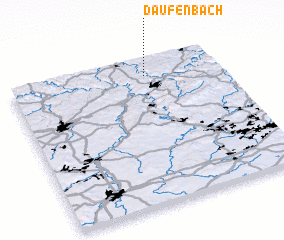 Places with similar names to Daufenbach, Germany ::
// Tiefenbach (CH)
// Teufenbach (AT)
// Teufenbach (AT)
// Tiefenbach (AT)
// Tiefenbach (AT)
// Tiefenbach (AT)
// Tiefenbach (AT)
// Tiefenbach (AT)
// Tiefenbach (AT)
// Daufenbach (DE)
Disclaimer :: Information on this page comes without warranty of any kind |
||
|
Where is Daufenbach? Elevation and coordinates ::
Latitude (lat): 49°53'0"N Longitude (lon): 6°39'0"E
Elevation (approx.): 327m (map arrows pan, magnifying glasses zoom) |
||
|
Visiting Daufenbach? Hotel/Accommodation ::
Book a hotel in Daufenbach Travel Guide ::
Buy a travel guide for Germany rental cars ::
car rental offers GPS waypoint ::
download a GPX waypoint (PoI) of Daufenbach for your GPS receiver
|
||