|
search place name
|
||
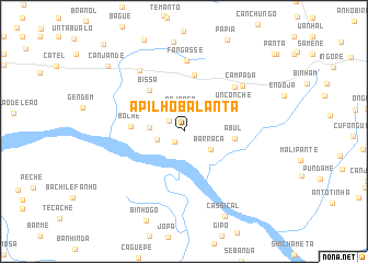
Apilho Balanta (Cacheu, Guinea-Bissau)Apilho Balanta is a town in the Cacheu region of Guinea-Bissau. An overview map of the region around Apilho Balanta is displayed below.
regional and 3d topo map of Apilho Balanta, Guinea-Bissau ::
Apilho Balanta airports ::
The nearest airport is ZIG - Ziguinchor, located 44.3 km north west of Apilho Balanta.
Other airports nearby include BXO - Bissau Oswaldo Vieira Intl (58.5 km south east), CSK - Cap Skiring (88.5 km west), BJL - Banjul Intl (134.6 km north west), KLC - Kaolack (199.6 km north), Nearby towns ::
Apilho (1.5km south west) //
Amone (1.8km north west) //
Bajonga (2.2km north) //
Mata Galinha (2.8km west) //
Barraca (3.2km south east) //
Achinde (3.5km west) //
Buache (4.2km north west) //
Abul (5.1km east) //
Bissa (5.4km north west) //
Secote (5.4km north west) //
Boche (5.4km west) //
Unconche (5.7km north east) //
Sedengal (5.8km north) //
Abulzinho (6.8km north east) //
Fangasse (7.2km north) //
Campada (7.5km north east) //
Aquinchá (7.6km north west) //
Cassícal (9.6km south east) //
Canjande (10.1km north west) //
Coitoto (12.0km north west) //
[all distances 'as the bird flies' and approximate] 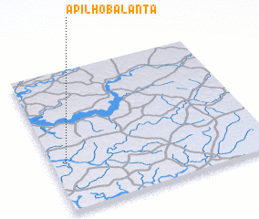 Places with similar names to Apilho Balanta, Guinea-Bissau :: Disclaimer :: Information on this page comes without warranty of any kind |
||
|
Where is Apilho Balanta? Elevation and coordinates ::
Latitude (lat): 12°20'46"N Longitude (lon): 15°56'5"W
Elevation (approx.): 23m (map arrows pan, magnifying glasses zoom) |
||
|
Visiting Apilho Balanta? Hotel/Accommodation ::
Book a hotel in Apilho Balanta Travel Guide ::
rental cars ::
car rental offers GPS waypoint ::
download a GPX waypoint (PoI) of Apilho Balanta for your GPS receiver
|
||