|
search place name
|
||
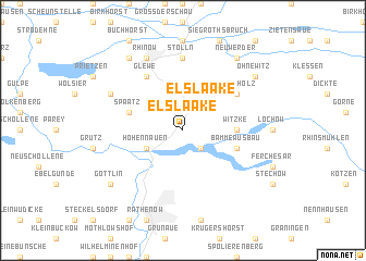
Elslaake (Brandenburg, Germany)Elslaake is a town in the Brandenburg region of Germany. An overview map of the region around Elslaake is displayed below.
regional and 3d topo map of Elslaake, Germany ::
Elslaake airports ::
The nearest airport is TXL - Berlin Tegel, located 63.9 km east of Elslaake.
Other airports nearby include THF - Berlin Tempelhof (74.1 km east), SXF - Berlin Schonefeld (85.4 km south east), SZW - Schwerin Parchim (91.5 km north west), BWE - Braunschweig Wolfsburg (129.5 km west), Nearby towns ::
Semlin (2.2km south east) //
Wassersuppe (2.2km south east) //
Elslaake (2.2km north east) //
Hohennauen (2.9km south west) //
Witzke (3.4km east) //
Bamme Ausbau (3.8km south east) //
Spaatz (3.8km north west) //
Glewe (6.0km north) //
Schönholz (5.0km north east) //
Stölln (7.4km north) //
Hohenwinkel (5.8km north west) //
Rhinow (7.7km north) //
Ohnewitz (7.1km north east) //
Kietz (8.1km north west) //
Neuwerder (8.1km north east) //
Göttlin (7.2km south west) //
[all distances 'as the bird flies' and approximate] 
Disclaimer :: Information on this page comes without warranty of any kind |
||
|
Where is Elslaake? Elevation and coordinates ::
Latitude (lat): 52°41'0"N Longitude (lon): 12°22'0"E
Elevation (approx.): 25m (map arrows pan, magnifying glasses zoom) |
||
|
Visiting Elslaake? Hotel/Accommodation ::
Book a hotel in Elslaake Travel Guide ::
Buy a travel guide for Germany rental cars ::
car rental offers GPS waypoint ::
download a GPX waypoint (PoI) of Elslaake for your GPS receiver
|
||