|
search place name
|
||
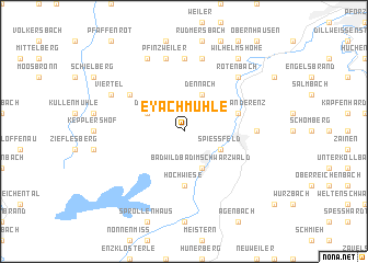
Eyachmühle (Baden-Württemberg, Germany)Eyachmühle is a town in the Baden-Württemberg region of Germany. An overview map of the region around Eyachmühle is displayed below.
regional and 3d topo map of Eyachmühle, Germany ::
Eyachmühle airports ::
The nearest airport is ZCC - Baden-baden Baden Oos, located 25.5 km west of Eyachmühle.
Other airports nearby include STR - Stuttgart (51.7 km east), ZQC - Speyer (58.1 km north), SXB - Strassbourg Entzheim (72.0 km west), MHG - Mannheim City (76.7 km north), Nearby towns ::
Dobel (3.1km north west) //
Bad Wildbad im Schwarzwald (3.9km south) //
Spießfeld (3.1km south east) //
Calmbach (3.1km south east) //
Dennach (3.9km north) //
Hochwiese (5.6km south) //
Höfen an der Enz (4.1km north east) //
Neusatz (5.2km north west) //
Conweiler (7.4km north) //
Charlottenhöhe (4.9km east) //
Feldrennach (7.4km north) //
Pfinzweiler (7.5km north) //
Schwann (7.5km north) //
Rotenbach (6.7km north east) //
Neuenbürg (6.7km north east) //
Rotensol (6.1km north west) //
Viertel (6.1km north west) //
Langenalb (7.8km north) //
Wilhelmshöhe (8.3km north east) //
[all distances 'as the bird flies' and approximate] 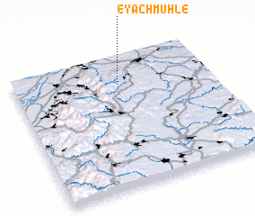 Places with similar names to Eyachmühle, Germany :: Disclaimer :: Information on this page comes without warranty of any kind |
||
|
Where is Eyachmühle? Elevation and coordinates ::
Latitude (lat): 48°47'0"N Longitude (lon): 8°32'0"E
Elevation (approx.): 528m (map arrows pan, magnifying glasses zoom) |
||
|
Visiting Eyachmühle? Hotel/Accommodation ::
Book a hotel in Eyachmühle Travel Guide ::
Buy a travel guide for Germany rental cars ::
car rental offers GPS waypoint ::
download a GPX waypoint (PoI) of Eyachmühle for your GPS receiver
|
||