|
search place name
|
||
Falkenhagen (Brandenburg, Germany)Falkenhagen is a town in the Brandenburg region of Germany. An overview map of the region around Falkenhagen is displayed below.
regional and 3d topo map of Falkenhagen, Germany ::

Falkenhagen airports ::
The nearest airport is SXF - Berlin Schonefeld, located 54.4 km west of Falkenhagen.
Other airports nearby include THF - Berlin Tempelhof (62.2 km west), TXL - Berlin Tegel (71.3 km west), IEG - Zielona Gora Babimost (106.3 km east), SZZ - Szczechin Goleniow (134.0 km north), Nearby towns ::
Georgenthal (2.2km south west) //
Petershagen (3.9km south) //
Regenmantel (2.9km north west) //
Lietzen (4.3km north east) //
Komturei Lietzen (5.7km north) //
Lietzen-Nord (5.7km north) //
Döbberin (3.9km north east) //
Wilmersdorf (5.0km south west) //
Marxdorf (6.0km north) //
Alt Madlitz (6.0km south) //
Neuentempel (7.4km north) //
Arensdorf (4.5km west) //
Neues Vorwerk (6.5km north east) //
Sieversdorf (6.5km south east) //
Petersdorf (7.8km south) //
Neu Mahlisch (7.2km north east) //
Neu Madlitz (8.7km south west) //
[all distances 'as the bird flies' and approximate] 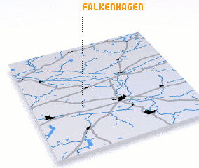 Places with similar names to Falkenhagen, Germany ::
// Falkenhagen (DE)
// Falkenhagen (DE)
// Falkenhagen (DE)
// Falkenhagen (DE)
// Falkenhagen (DE)
// Falkenhagen (DE)
Disclaimer :: Information on this page comes without warranty of any kind |
||
|
Where is Falkenhagen? Elevation and coordinates ::
Latitude (lat): 52°26'0"N Longitude (lon): 14°19'0"E
Elevation (approx.): 62m (map arrows pan, magnifying glasses zoom) |
||
|
Visiting Falkenhagen? Hotel/Accommodation ::
Book a hotel in Falkenhagen Travel Guide ::
Buy a travel guide for Germany rental cars ::
car rental offers GPS waypoint ::
download a GPX waypoint (PoI) of Falkenhagen for your GPS receiver
|
||