|
search place name
|
||
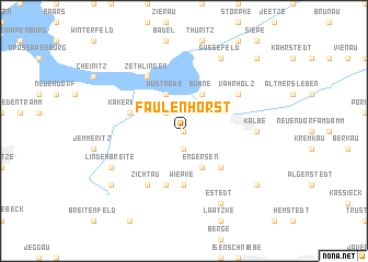
Faulenhorst (Sachsen-Anhalt, Germany)Faulenhorst is a town in the Sachsen-Anhalt region of Germany. An overview map of the region around Faulenhorst is displayed below.
regional and 3d topo map of Faulenhorst, Germany ::
Faulenhorst airports ::
The nearest airport is BWE - Braunschweig Wolfsburg, located 64.4 km south west of Faulenhorst.
Other airports nearby include ZCN - Celle (89.0 km west), SZW - Schwerin Parchim (91.6 km north), HAJ - Hannover (113.7 km west), TXL - Berlin Tegel (132.8 km east), Nearby towns ::
Wernstedt (0.0km north) //
Neu Wernstedt (1.9km south) //
Winkelstedt (2.2km north west) //
Wustrewe (3.9km north) //
Engersen (3.9km south) //
Bühne (3.9km north) //
Klein Engersen (4.3km south east) //
Wiepke (5.6km south) //
Rothekrug (5.7km south) //
Kakerbeck (3.8km north west) //
Zichtau (6.0km south) //
Vahrholz (5.0km north east) //
Zethlingen (6.0km north) //
Kalbe (4.5km east) //
Lindenbreite (5.8km south west) //
Güssefeld (7.7km north) //
Estedt (7.7km south) //
Schwiesau (7.2km south west) //
Schenkenhorst (7.2km south east) //
Vietzen (8.7km north east) //
[all distances 'as the bird flies' and approximate] 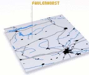 Places with similar names to Faulenhorst, Germany :: Disclaimer :: Information on this page comes without warranty of any kind |
||
|
Where is Faulenhorst? Elevation and coordinates ::
Latitude (lat): 52°39'0"N Longitude (lon): 11°20'0"E
Elevation (approx.): 47m (map arrows pan, magnifying glasses zoom) |
||
|
Visiting Faulenhorst? Hotel/Accommodation ::
Book a hotel in Faulenhorst Travel Guide ::
Buy a travel guide for Germany rental cars ::
car rental offers GPS waypoint ::
download a GPX waypoint (PoI) of Faulenhorst for your GPS receiver
|
||