|
search place name
|
||
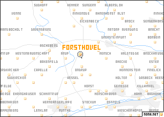
Forsthövel (Nordrhein-Westfalen, Germany)Forsthövel is a town in the Nordrhein-Westfalen region of Germany. An overview map of the region around Forsthövel is displayed below.
regional and 3d topo map of Forsthövel, Germany ::
Forsthövel airports ::
The nearest airport is DTM - Dortmund, located 28.1 km south of Forsthövel.
Other airports nearby include ZCA - Arnsberg Menden (34.9 km south east), FMO - Muenster/osnabrueck Munster Osnabruck (40.9 km north), GUT - Guetersloh Gutersloh (46.3 km east), ESS - Essen Mulheim (65.7 km south west), Nearby towns ::
Herbern (1.9km south) //
Arup (2.3km west) //
Ondrup (3.7km south) //
Rieth (2.9km north east) //
Nordick (3.9km south) //
Ossenbeck (4.4km north east) //
Mersch (3.4km east) //
Wessel (5.7km south) //
Horn (6.0km south) //
Lütke (4.6km west) //
Altendorf (7.5km north) //
Ascheberg (4.9km west) //
Hegemer (4.9km west) //
Eickenbeck (7.5km north) //
Bakenfeld (4.9km west) //
Horst (7.5km south) //
Drensteinfurt (5.9km north east) //
Holsen (7.8km south) //
Natorp (7.2km north east) //
Bockum-Hövel (8.2km south east) //
[all distances 'as the bird flies' and approximate] 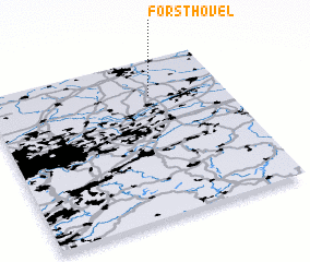 Places with similar names to Forsthövel, Germany :: Disclaimer :: Information on this page comes without warranty of any kind |
||
|
Where is Forsthövel? Elevation and coordinates ::
Latitude (lat): 51°46'0"N Longitude (lon): 7°41'0"E
Elevation (approx.): 69m (map arrows pan, magnifying glasses zoom) |
||
|
Visiting Forsthövel? Hotel/Accommodation ::
Book a hotel in Forsthövel Travel Guide ::
Buy a travel guide for Germany rental cars ::
car rental offers GPS waypoint ::
download a GPX waypoint (PoI) of Forsthövel for your GPS receiver
|
||