|
search place name
|
||
Fürstensee (Mecklenburg-Vorpommern, Germany)Fürstensee is a town in the Mecklenburg-Vorpommern region of Germany. An overview map of the region around Fürstensee is displayed below.
regional and 3d topo map of Fürstensee, Germany ::

Fürstensee airports ::
The nearest airport is TXL - Berlin Tegel, located 82.9 km south of Fürstensee.
Other airports nearby include RLG - Laage (89.8 km north west), SZW - Schwerin Parchim (92.1 km west), THF - Berlin Tempelhof (93.6 km south), SXF - Berlin Schonefeld (105.4 km south), Nearby towns ::
Domjüch (2.2km north west) //
Godendorf (3.7km south) //
Herzwolde (3.3km east) //
Wokuhl (3.8km south east) //
Godendorfer Teerofen (5.7km south) //
Drewin (3.8km south west) //
Wutschendorf (3.8km north east) //
Strelitz Alt (5.0km north west) //
Grammertin (4.4km east) //
Klein Trebbow (4.4km west) //
Neubrück (4.8km south east) //
Altthymen (7.5km south) //
Zinow (7.5km north) //
Dabelow (6.5km south east) //
Düsterförde (6.5km south west) //
Brückentin (5.8km south east) //
Carolinenhof (8.6km south east) //
Neustrelitz (8.6km north west) //
[all distances 'as the bird flies' and approximate] 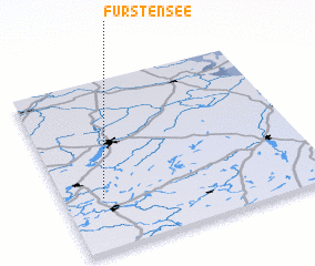 Places with similar names to Fürstensee, Germany ::
// Fourstones (GB)
Disclaimer :: Information on this page comes without warranty of any kind |
||
|
Where is Fürstensee? Elevation and coordinates ::
Latitude (lat): 53°18'0"N Longitude (lon): 13°9'0"E
Elevation (approx.): 71m (map arrows pan, magnifying glasses zoom) |
||
|
Visiting Fürstensee? Hotel/Accommodation ::
Book a hotel in Fürstensee Travel Guide ::
Buy a travel guide for Germany rental cars ::
car rental offers GPS waypoint ::
download a GPX waypoint (PoI) of Fürstensee for your GPS receiver
|
||