|
search place name
|
||
Hagenstetten (Bayern, Germany)Hagenstetten is a town in the Bayern region of Germany. An overview map of the region around Hagenstetten is displayed below.
regional and 3d topo map of Hagenstetten, Germany ::

Hagenstetten airports ::
The nearest airport is MUC - Munich Munchen, located 54.5 km south of Hagenstetten.
Other airports nearby include AGB - Augsburg (68.8 km south west), FEL - Fuerstenfeldbruck Furstenfeldbruck (74.9 km south), NUE - Nuernberg Nurnberg (84.7 km north west), OBF - Oberpfaffenhofen (87.5 km south), Nearby towns ::
Hiendorf (0.0km north) //
Unterdolling (1.2km west) //
Harlanden (2.2km south west) //
Offendorf (2.2km north west) //
Hüttenhausen (2.2km north west) //
Weiher (2.2km north west) //
Mindelstetten (2.2km north east) //
Oberhartheim (3.7km south) //
Tettenagger (3.7km north) //
Pleiling (3.9km south) //
Weißendorf (3.1km north west) //
Ettling (3.1km south east) //
Oberoffendorf (3.9km north) //
Stockau (3.9km north) //
Imbath (3.1km north east) //
Grashausen (3.9km north) //
Dötting (4.4km south east) //
Biber (4.4km north west) //
Mendorf (4.4km north west) //
Schwabstetten (4.4km north east) //
Forchheim (3.7km east) //
Oberdolling (3.7km west) //
Viehhausen (5.7km north) //
Oberdünzing (5.7km south) //
Pförring (4.1km south east) //
Theißing (4.1km south west) //
Dünzing (5.7km south) //
Menning (6.1km south west) //
Pettling (5.2km south west) //
[all distances 'as the bird flies' and approximate] 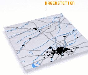 Places with similar names to Hagenstetten, Germany :: Disclaimer :: Information on this page comes without warranty of any kind |
||
|
Where is Hagenstetten? Elevation and coordinates ::
Latitude (lat): 48°50'0"N Longitude (lon): 11°38'0"E
Elevation (approx.): 419m (map arrows pan, magnifying glasses zoom) |
||
|
Visiting Hagenstetten? Hotel/Accommodation ::
Book a hotel in Hagenstetten Travel Guide ::
Buy a travel guide for Germany rental cars ::
car rental offers GPS waypoint ::
download a GPX waypoint (PoI) of Hagenstetten for your GPS receiver
|
||