|
search place name
|
||
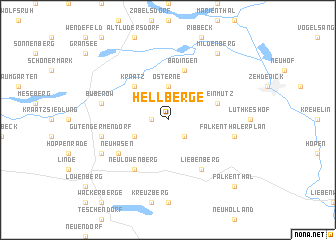
Hellberge (Brandenburg, Germany)Hellberge is a town in the Brandenburg region of Germany. An overview map of the region around Hellberge is displayed below.
regional and 3d topo map of Hellberge, Germany ::
Hellberge airports ::
The nearest airport is TXL - Berlin Tegel, located 43.6 km south of Hellberge.
Other airports nearby include THF - Berlin Tempelhof (54.3 km south), SXF - Berlin Schonefeld (66.4 km south), SZW - Schwerin Parchim (110.5 km north west), RLG - Laage (125.1 km north west), Nearby towns ::
Häsen (1.1km west) //
Bergsdorf (2.2km south east) //
Osterne (3.7km north) //
Klewesche Häuser (2.9km south west) //
Kraatz (4.3km north west) //
Badingen (5.7km north) //
Kleinmutz (3.8km north east) //
Neuhäsen (5.0km south west) //
Neulöwenberg (6.0km south) //
Liebenberg (6.0km south) //
Buberow (4.8km north west) //
Gutengermendorf (4.8km south west) //
Falkenthaler Plan (4.8km south east) //
Moncaprice (5.8km south west) //
Mildenberg (8.1km north east) //
Falkenthal (8.7km south east) //
[all distances 'as the bird flies' and approximate] 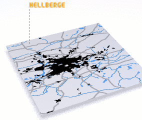 Places with similar names to Hellberge, Germany ::
// Whaley Bridge (GB)
// Hell Bridge (IE)
Disclaimer :: Information on this page comes without warranty of any kind |
||
|
Where is Hellberge? Elevation and coordinates ::
Latitude (lat): 52°57'0"N Longitude (lon): 13°14'0"E
Elevation (approx.): 63m (map arrows pan, magnifying glasses zoom) |
||
|
Visiting Hellberge? Hotel/Accommodation ::
Book a hotel in Hellberge Travel Guide ::
Buy a travel guide for Germany rental cars ::
car rental offers GPS waypoint ::
download a GPX waypoint (PoI) of Hellberge for your GPS receiver
|
||