|
search place name
|
||
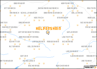
Helpershain (Hessen, Germany)Helpershain is a town in the Hessen region of Germany. An overview map of the region around Helpershain is displayed below.
regional and 3d topo map of Helpershain, Germany ::
Helpershain airports ::
The nearest airport is ZNF - Hanau Aaf, located 51.2 km south of Helpershain.
Other airports nearby include FRA - Frankfurt Main (79.8 km south west), KSF - Kassel Calden (90.6 km north), GHF - Giebelstadt Aaf (118.7 km south east), PAD - Paderborn Lippstadt (120.4 km north), Nearby towns ::
Ulrichstein (2.2km south west) //
Köddingen (2.2km north west) //
Rebgeshain (3.9km south) //
Meiches (3.0km north east) //
Engelrod (3.0km south east) //
Stumpertenrod (3.0km north west) //
Langwasser (4.4km south west) //
Windhausen (5.7km north) //
Eichelhain (5.1km south east) //
Kestrich (6.0km north west) //
Feldkrücken (6.0km south west) //
Unter Seibertenrod (4.7km west) //
Lautertal (5.1km east) //
Hörgenau (5.1km east) //
Ober Breidenbach (7.5km north) //
Ober Seibertenrod (5.1km west) //
Groß Felda (6.6km north west) //
Storndorf (6.6km north east) //
Kölzenhain (6.6km south west) //
Eichenrod (6.0km south east) //
Zeilbach (6.0km north west) //
Klein Felda (6.0km north west) //
Vadenrod (8.2km north east) //
Schellnhausen (8.8km north west) //
[all distances 'as the bird flies' and approximate]  Places with similar names to Helpershain, Germany :: Disclaimer :: Information on this page comes without warranty of any kind |
||
|
Where is Helpershain? Elevation and coordinates ::
Latitude (lat): 50°36'0"N Longitude (lon): 9°13'0"E
Elevation (approx.): 542m (map arrows pan, magnifying glasses zoom) |
||
|
Visiting Helpershain? Hotel/Accommodation ::
Book a hotel in Helpershain Travel Guide ::
Buy a travel guide for Germany rental cars ::
car rental offers GPS waypoint ::
download a GPX waypoint (PoI) of Helpershain for your GPS receiver
|
||