|
search place name
|
||
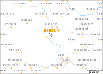
Hemeln (Niedersachsen, Germany)Hemeln is a town in the Niedersachsen region of Germany. An overview map of the region around Hemeln is displayed below.
regional and 3d topo map of Hemeln, Germany ::
Hemeln airports ::
The nearest airport is KSF - Kassel Calden, located 19.5 km south west of Hemeln.
Other airports nearby include PAD - Paderborn Lippstadt (70.5 km west), GUT - Guetersloh Gutersloh (102.1 km north west), HAJ - Hannover (107.0 km north), ERF - Erfurt (110.1 km south east), Nearby towns ::
Veckerhagen (1.2km west) //
Vaake (1.9km south) //
Glashütte (3.7km north) //
Bursfelde (3.9km north) //
Ellershausen bei Münden (5.0km east) //
Bühren (5.0km east) //
Weißehütte (7.5km north) //
Fürstenhagen (7.8km north) //
Gimte (7.8km south) //
Gottstreu (7.8km north) //
Volkmarshausen (8.2km south east) //
[all distances 'as the bird flies' and approximate]  Places with similar names to Hemeln, Germany ::
Disclaimer :: Information on this page comes without warranty of any kind |
||
|
Where is Hemeln? Elevation and coordinates ::
Latitude (lat): 51°30'0"N Longitude (lon): 9°37'0"E
Elevation (approx.): 132m (map arrows pan, magnifying glasses zoom) |
||
|
Visiting Hemeln? Hotel/Accommodation ::
Book a hotel in Hemeln Travel Guide ::
Buy a travel guide for Germany rental cars ::
car rental offers GPS waypoint ::
download a GPX waypoint (PoI) of Hemeln for your GPS receiver
|
||