|
search place name
|
||
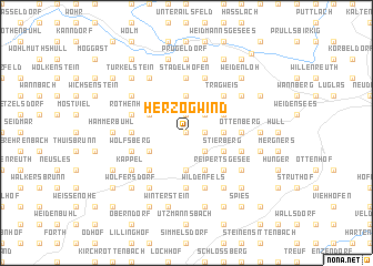
Herzogwind (Bayern, Germany)Herzogwind is a town in the Bayern region of Germany. An overview map of the region around Herzogwind is displayed below.
regional and 3d topo map of Herzogwind, Germany ::
Herzogwind airports ::
The nearest airport is NUE - Nuernberg Nurnberg, located 30.3 km south west of Herzogwind.
Other airports nearby include BYU - Bayreuth (37.8 km north east), HOQ - Hof Plauen (74.8 km north east), GHF - Giebelstadt Aaf (100.0 km west), KLV - Karlovy Vary (125.5 km north east), Nearby towns ::
Obertrubach (0.0km north) //
Bärnfels (1.9km north) //
Leienfels (1.2km east) //
Soranger (2.2km north east) //
Neudorf (2.2km south east) //
Kleingesee (3.7km north) //
Allersdorf (3.7km north) //
Leupoldstein (2.4km east) //
Almos (3.7km south) //
Geschwand (3.0km north west) //
Leimersberg (3.0km north west) //
Linden (3.0km north west) //
Graisch (3.0km north east) //
Schossaritz (3.0km south west) //
Stierberg (3.0km south east) //
Münchs (3.9km south) //
Trägweis (4.4km north east) //
Hiltpoltstein (4.4km south west) //
Reipertsgesee (4.4km south east) //
Stadelhofen (5.6km north) //
Dörfles (3.6km west) //
Ottenberg (3.6km east) //
Altenwiesen (3.6km east) //
Möchs (5.6km south) //
Rothenhof (4.0km north west) //
Geiselhöhe (5.7km north) //
Wolfsberg (4.0km south west) //
Untertrubach (4.0km south west) //
Fischstein (4.0km south east) //
[all distances 'as the bird flies' and approximate] 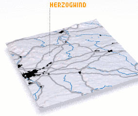 Places with similar names to Herzogwind, Germany :: Disclaimer :: Information on this page comes without warranty of any kind |
||
|
Where is Herzogwind? Elevation and coordinates ::
Latitude (lat): 49°42'0"N Longitude (lon): 11°21'0"E
Elevation (approx.): 508m (map arrows pan, magnifying glasses zoom) |
||
|
Visiting Herzogwind? Hotel/Accommodation ::
Book a hotel in Herzogwind Travel Guide ::
Buy a travel guide for Germany rental cars ::
car rental offers GPS waypoint ::
download a GPX waypoint (PoI) of Herzogwind for your GPS receiver
|
||