|
search place name
|
||
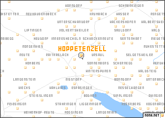
Hoppetenzell (Baden-Württemberg, Germany)Hoppetenzell is a town in the Baden-Württemberg region of Germany. An overview map of the region around Hoppetenzell is displayed below.
regional and 3d topo map of Hoppetenzell, Germany ::
Hoppetenzell airports ::
The nearest airport is ZQL - Donaueschingen Villingen, located 38.3 km west of Hoppetenzell.
Other airports nearby include FDH - Friedrichshafen (43.9 km south east), ZRH - Zurich (58.3 km south west), ACH - St Gallen Altenrhein (60.2 km south east), STR - Stuttgart (91.0 km north), Nearby towns ::
Schmelze (1.2km west) //
Burgtal (2.2km south east) //
Windegg (2.2km south west) //
Bleiche (2.2km south west) //
Zizenhausen (2.2km south west) //
Hindelwangen (2.2km south west) //
Berenberg (2.2km north east) //
Stockach (3.7km south) //
Ursaul (2.5km east) //
Mühlingen (3.7km north) //
Mainwangen (3.7km north) //
Airach (3.9km south) //
Sonnenberg (3.1km south east) //
Hengelau (3.1km south east) //
Zoznegg (3.1km north east) //
Mahlspüren im Hegau (3.1km south west) //
Äußeres Hecheln (3.1km north west) //
Gallmannsweil (3.9km north) //
Winterspüren (4.5km south east) //
Schwackenreute (4.5km north east) //
Inneres Hecheln (4.5km north west) //
Raithaslach (3.7km west) //
Boll (5.7km north) //
Rißtorf (5.7km south) //
Volkertsweiler (5.7km north) //
Holzach (5.7km north) //
Espasingen (7.4km south) //
Ratzenweiler (5.0km east) //
Münchhöf (5.0km west) //
[all distances 'as the bird flies' and approximate] 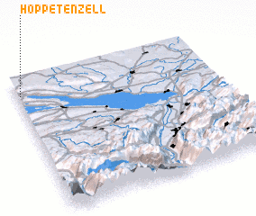 Places with similar names to Hoppetenzell, Germany :: Disclaimer :: Information on this page comes without warranty of any kind |
||
|
Where is Hoppetenzell? Elevation and coordinates ::
Latitude (lat): 47°53'0"N Longitude (lon): 9°1'0"E
Elevation (approx.): 655m (map arrows pan, magnifying glasses zoom) |
||
|
Visiting Hoppetenzell? Hotel/Accommodation ::
Book a hotel in Hoppetenzell Travel Guide ::
Buy a travel guide for Germany rental cars ::
car rental offers GPS waypoint ::
download a GPX waypoint (PoI) of Hoppetenzell for your GPS receiver
|
||