|
search place name
|
||
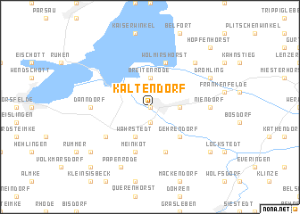
Kaltendorf (Sachsen-Anhalt, Germany)Kaltendorf is a town in the Sachsen-Anhalt region of Germany. An overview map of the region around Kaltendorf is displayed below.
regional and 3d topo map of Kaltendorf, Germany ::
Kaltendorf airports ::
The nearest airport is BWE - Braunschweig Wolfsburg, located 31.7 km south west of Kaltendorf.
Other airports nearby include ZCN - Celle (67.6 km west), HAJ - Hannover (88.3 km west), SZW - Schwerin Parchim (123.0 km north east), LEJ - Leipzig Halle (141.0 km south east), Nearby towns ::
Oebisfelde (0.0km north) //
Büstedt (1.9km south) //
Wassensdorf (2.2km north east) //
Breitenrode (3.7km north) //
Weddendorf (2.3km east) //
Wahrstedt (3.9km south) //
Grafhorst (2.9km north west) //
Gehrendorf (4.3km south east) //
Meinkot (5.7km south) //
Wolmirshorst (5.7km north) //
Bahrdorf (5.7km south) //
Velpke (5.0km south west) //
Danndorf (4.5km west) //
Niendorf (4.5km east) //
Buchhorst (6.5km north east) //
Papenrode (7.8km south) //
Drömling (5.8km north east) //
Klein Twülpstedt (7.2km south west) //
Saalsdorf (7.2km south east) //
Groß Twülpstedt (8.7km south west) //
Hopfenhorst (8.7km north east) //
[all distances 'as the bird flies' and approximate]  Places with similar names to Kaltendorf, Germany ::
Disclaimer :: Information on this page comes without warranty of any kind |
||
|
Where is Kaltendorf? Elevation and coordinates ::
Latitude (lat): 52°26'0"N Longitude (lon): 10°59'0"E
Elevation (approx.): 66m (map arrows pan, magnifying glasses zoom) |
||
|
Visiting Kaltendorf? Hotel/Accommodation ::
Book a hotel in Kaltendorf Travel Guide ::
Buy a travel guide for Germany rental cars ::
car rental offers GPS waypoint ::
download a GPX waypoint (PoI) of Kaltendorf for your GPS receiver
|
||