|
search place name
|
||
Kettenheim (Nordrhein-Westfalen, Germany)Kettenheim is a town in the Nordrhein-Westfalen region of Germany. An overview map of the region around Kettenheim is displayed below.
regional and 3d topo map of Kettenheim, Germany ::

Kettenheim airports ::
The nearest airport is CGN - Cologne Koln Bonn, located 40.4 km east of Kettenheim.
Other airports nearby include GKE - Geilenkirchen (45.7 km north west), MGL - Moenchengladbach Monchengladbach (53.9 km north), DUS - Duesseldorf Dusseldorf (61.1 km north), MST - Maastricht (61.2 km west), Nearby towns ::
Kelz (1.9km north) //
Vettweiß (1.9km south) //
Mersheim (2.3km east) //
Jakobwüllesheim (3.0km north west) //
Frangenheim (3.0km south west) //
Gladbach (3.0km north east) //
Lüxheim (3.0km north east) //
Froitzheim (3.9km south) //
Isweiler (3.9km north) //
Irresheim (3.9km north) //
Frauwüllesheim (4.4km north west) //
Eggersheim (4.4km north east) //
Füssenich (5.7km south) //
Hommelsheim (5.7km north) //
Soller (4.0km south west) //
Ginnick (6.0km south west) //
Geich (6.0km south east) //
Hochkirchen (6.0km north east) //
Rommelsheim (5.1km north west) //
Bessenich (5.1km south east) //
Juntersdorf (7.4km south) //
Müddersheim (4.7km east) //
Ollesheim (7.5km north) //
Eschweiler über Feld (7.5km north) //
Langendorf (7.5km south) //
Stockheim (5.0km west) //
Sievernich (5.0km east) //
Disternich (5.0km east) //
Zülpich (6.6km south east) //
[all distances 'as the bird flies' and approximate] 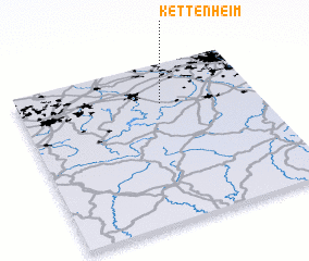 Places with similar names to Kettenheim, Germany ::
// Gattenham (DE)
// Kottenheim (DE)
// Kettenham (DE)
// Kottenheim (DE)
// Kettenheim (DE)
// Gottenheim (DE)
// Kadonohama (JP)
// Coddenham (GB)
// Cottenham (GB)
// Quidenham (GB)
Disclaimer :: Information on this page comes without warranty of any kind |
||
|
Where is Kettenheim? Elevation and coordinates ::
Latitude (lat): 50°45'0"N Longitude (lon): 6°36'0"E
Elevation (approx.): 143m (map arrows pan, magnifying glasses zoom) |
||
|
Visiting Kettenheim? Hotel/Accommodation ::
Book a hotel in Kettenheim Travel Guide ::
Buy a travel guide for Germany rental cars ::
car rental offers GPS waypoint ::
download a GPX waypoint (PoI) of Kettenheim for your GPS receiver
|
||