|
search place name
|
||
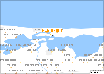
Klein Kirr (Mecklenburg-Vorpommern, Germany)Klein Kirr is a town in the Mecklenburg-Vorpommern region of Germany. An overview map of the region around Klein Kirr is displayed below.
regional and 3d topo map of Klein Kirr, Germany ::
Klein Kirr airports ::
The nearest airport is RLG - Laage, located 62.9 km south west of Klein Kirr.
Other airports nearby include SZW - Schwerin Parchim (126.6 km south west), MMX - Malmoe Sturup (130.5 km north), CPH - Copenhagen Kastrup (133.8 km north), RKE - Copenhagen Roskilde (135.7 km north), Nearby towns ::
Groß Kirr (2.1km north west) //
Müggenburg (2.1km north east) //
Barth (5.6km south) //
Viehhof (5.6km south) //
Zingst (3.7km north west) //
Bresewitz (3.7km south west) //
Glöwitz (6.0km south) //
Fahrenkamp (4.9km south east) //
Pruchten (5.7km south west) //
Gutglück (7.0km south west) //
Küstrow (8.1km south east) //
Dabitz (8.6km south east) //
[all distances 'as the bird flies' and approximate] 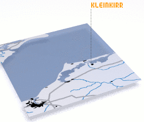 Places with similar names to Klein Kirr, Germany ::
// Gleinkerau (AT)
// Glengary (US)
// Klein Icker (DE)
// Klein Nieköhr (DE)
// Calnegre (ES)
// Glengarry (ZA)
// Glen Grey (ZA)
// Glen Query (US)
// Glengary (US)
// Glengary (US)
Disclaimer :: Information on this page comes without warranty of any kind |
||
|
Where is Klein Kirr? Elevation and coordinates ::
Latitude (lat): 54°25'0"N Longitude (lon): 12°44'0"E
Elevation (approx.): -32768m (map arrows pan, magnifying glasses zoom) |
||
|
Visiting Klein Kirr? Hotel/Accommodation ::
Book a hotel in Klein Kirr Travel Guide ::
Buy a travel guide for Germany rental cars ::
car rental offers GPS waypoint ::
download a GPX waypoint (PoI) of Klein Kirr for your GPS receiver
|
||