|
search place name
|
||
Klinga (Sachsen, Germany)Klinga is a town in the Sachsen region of Germany. An overview map of the region around Klinga is displayed below.
regional and 3d topo map of Klinga, Germany ::

Klinga airports ::
The nearest airport is AOC - Altenburg Nobitz, located 32.9 km south of Klinga.
Other airports nearby include LEJ - Leipzig Halle (32.9 km north west), DRS - Dresden (80.6 km east), KLV - Karlovy Vary (120.0 km south), ERF - Erfurt (121.5 km west), Nearby towns ::
Großsteinberg (1.9km south) //
Staudnitz (2.2km north east) //
Pomssen (2.2km south west) //
Ammelshain (3.7km north) //
Lindhardt (2.3km west) //
Naunhof (3.0km north west) //
Grethen (4.4km south east) //
Beiersdorf (3.5km east) //
Erdmannshain (3.9km north west) //
Groitzsch (5.7km south) //
Polenz (5.7km north) //
Köhra (5.0km west) //
Otterwisch (7.5km south) //
Großbuch (7.5km south) //
Kleinsteinberg (6.6km north west) //
Albrechtshain (5.9km north west) //
Brandis (7.8km north) //
Leulitz (7.8km north) //
Altenhain (5.9km north east) //
Wolfshain (7.2km north west) //
Rohrbach (7.2km south west) //
Beucha (8.7km north west) //
Hainichen (8.7km south west) //
Großbardau (8.7km south east) //
[all distances 'as the bird flies' and approximate] 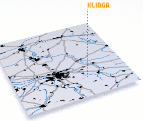 Places with similar names to Klinga, Germany ::
Disclaimer :: Information on this page comes without warranty of any kind |
||
|
Where is Klinga? Elevation and coordinates ::
Latitude (lat): 51°16'0"N Longitude (lon): 12°38'0"E
Elevation (approx.): 139m (map arrows pan, magnifying glasses zoom) |
||
|
Visiting Klinga? Hotel/Accommodation ::
Book a hotel in Klinga Travel Guide ::
Buy a travel guide for Germany rental cars ::
car rental offers GPS waypoint ::
download a GPX waypoint (PoI) of Klinga for your GPS receiver
|
||