|
search place name
|
||
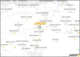
Langen (Hessen, Germany)Langen is a town in the Hessen region of Germany. An overview map of the region around Langen is displayed below.
regional and 3d topo map of Langen, Germany ::
nearby GPS traces from timatio ::
Langen airports ::
The nearest airport is FRA - Frankfurt Main, located 10.0 km west of Langen.
Other airports nearby include ZNF - Hanau Aaf (28.5 km north east), MHG - Mannheim City (59.0 km south), ZQC - Speyer (78.5 km south), ZNV - Koblenz Winningen (89.7 km north west), Nearby towns ::
Egelsbach (2.5km south) //
Buchschlag (2.6km north) //
Dreieich (2.1km east) //
Sprendlingen (3.2km north east) //
Bayerseich (4.8km south) //
Erzhausen (4.6km south west) //
Neulsenburg (6.3km north) //
Wixhausen (6.5km south) //
Neu Isenburg (6.6km north) //
Götzenhain (4.8km east) //
Zeppelinheim (6.0km north west) //
Offenthal (5.3km east) //
Arheilgen (9.0km south) //
Messel (7.8km south east) //
Gräfenhausen (8.7km south west) //
Ostende (10.0km south west) //
Gravenbruch (9.8km north east) //
[all distances 'as the bird flies' and approximate] 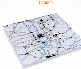 Places with similar names to Langen, Germany ::
Disclaimer :: Information on this page comes without warranty of any kind |
||
|
Where is Langen? Elevation and coordinates ::
Latitude (lat): 49°59'36"N Longitude (lon): 8°40'22"E
Elevation (approx.): 137m (map arrows pan, magnifying glasses zoom) |
||
|
Visiting Langen? Hotel/Accommodation ::
Book a hotel in Langen Travel Guide ::
Buy a travel guide for Germany rental cars ::
car rental offers GPS waypoint ::
download a GPX waypoint (PoI) of Langen for your GPS receiver
|
||